Blog Index

Sunday, July 28, 2013

Twentymile Creek Cascade


I made the long drive and short hike to Twentymile Creek Cascades in early July, 2013.  The trail head is just off of NC 28 between US 129 and Fontana Dam at the Twenty Mile Ranger Station.  There is a gravel parking area just beyond the station and maintenance buildings.  This trek is more of a stroll in the woods than a hike as it follows an old roadway for the first ½ mile of the 0.6 mile distance.  While the park service sign designates the location as "Twenty Mile", the NPS and US Geological Survey maps both designate the creek and region as "Twentymile."  While there were a number of vehicles in the parking lot, I only met one individual on the trail.

Other than this one downed tree, the trail was in great shape

Twentymile Creek is visible from the trail

Mountain laurel was still blooming

Another view of Twentymile Creek


The bridge over Moore Springs Branch

Moore Springs Branch from the trail bridge

Turn right at the trail junction at the end of the bridge

A short side trail leads to the cascades

Twentymile Creek Cascades from the access trail

Closeup of the upper section of the cascades

The creek flow is high due to recent heavy rains


The view downstream as the cascades continue

The park website is http://www.nps.gov/grsm/index.htm.

Saturday, July 13, 2013

Songbird Trail - TVA Norris Dam


A short break in the wet weather in early July, 2013, provided an opportunity for me to walk the two-mile Songbird Trail on the TVA Norris Dam reservation.  The trail is wide and surfaced with fine gravel except for a short section that is paved.  The eastern leg of the trail is mostly open fields while the western leg is mostly forested as it hugs the shore of the Clinch River below the dam.  Substantial bridges with handrails span the few creek and drainage crossings.  A short side trail leads to the water by way of a set of wooden stairs that also have a handrail.

A large, paved parking area is located at the upstream trailhead

The trail meanders through small groves of trees

Housing for some of the songbirds

The well maintained trail passes through open fields

Trees line both sides of the trail in some places

More open fields

Bridge over a very small creek

Path continues along the edge of  a field

Downstream trailhead

Clear Creek from the bridge

Bridge over Clear Creek leads to another parking area

Fog rises along the Clinch River due to the cold water
released through the turbines

The return trail is more secluded

Another bridge over an unnamed creek

The Clinch River as seen from the trail

Another view of the river from the bank

Stairs provide access from the trail to the water

Paved portion of the trail

Canoe launch facility

Norris Dam

Information about public trails maintained by TVA can be found at http://www.tva.gov/river/recreation/dispersed/trail-table_hold.htm.

Thursday, July 11, 2013

French Broad River to Craggy Gardens - Blue Ridge Parkway


A late June day trip to the Blue Ridge Parkway near Asheville, North Carolina provided some beautiful views before the fog and rain shortened our trip.  The parkway is a scenic 469 mile link between Shenandoah National Park and the Great Smoky Mountains National Park.  We traversed about 65 miles of the parkway from NC 191 just south of the French Broad River to NC 226 at Gillespie Gap.

View upstream from the French Broad River bridge toward Ball Mountain

View downstream from the French Broad River bridge

Visitor Center and Headquarters

Interior of the Visitor Center


Haw Creek Valley

Tanbark Ridge

The parkway from the Bull Creek Valley overlook

Bull Creek Valley

Lane Pinnacle

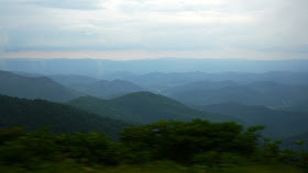
View northwest from the Craggy Gardens visitor center

Another view of the ridges northwest of the Craggy Gardens visitor center


The fog moves in at Craggy Gardens

A break in the fog provided a magnificent view along the road

View from Three Knobs overlook

The parkway website is http://www.nps.gov/blri/index.htm.