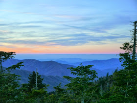
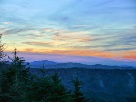
Blog Index

Monday, March 31, 2014

Tellico Blockhouse


On the same mid-January 2014  day we visited Fort Loudoun, I also visited the ruins of the Tellico Blockhouse across the Little Tennessee River.  This combination of fort and trading post was in use by the United States during a critical period from 1794 until 1807.  While not a factory in modern usage, the Tellico Factory in the blockhouse was used as a training center in an attempt to teach western practices to the Cherokee.  This included planting cotton along the Little Tennessee River and coercing the Cherokee into a more agrarian lifestyle by providing spinning wheels and looms.  Even though the blockhouse has not been reconstructed, the ruins have been restored and stabilized.  Tellico Blockhouse is part of the Fort Loudoun State Historic Area and is managed in conjunction with the Fort Loudoun State Historic Park.
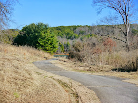
A paved road winds down from the parking area to the blockhouse

An overview of the ruins

The reconstructed Fort Loudoun is visible across the Little Tennessee River

Palisade to the north of the main gate

The main gate

Ruins to the north of the main gate

The well near the northwest corner of the blockhouse

Ruins along the north side of the blockhouse near Ninemile Creek

The southeast corner of the blockhouse including the Tellico Factory area inside the palisade fence

Ruins along the southern edge of the blockhouse including two hearths

Tellico Lake and the Appalachian Mountains

No admission fee is charged to visit the blockhouse.

The Fort Loudoun Association website is http://fortloudoun.com/.
The park website is http://tnstateparks.com/parks/about/fort-loudoun.

Sunday, March 30, 2014

Fort Loudoun State Historic Park


We visited Fort Loudoun State Historic Park on a sunny, but brisk, day in mid-January 2014.  Our first stop was at the visitor center.  A small museum, information desk, gift shop, auditorium, restrooms and offices are housed in the modern structure.  Due to a scheduled talk by a visiting British historian, the fifteen minute video "The Fort Loudoun Story" was not being shown.

The Seven Years War between Britain and France was called the French and Indian War in the American colonies.  In a desire to cement the relationship between the Cherokee and the South Carolina colony in opposition to the French, a fortress was built in 1756 and 1757 near several of the major Cherokee towns near the confluence of the Tellico and the Little Tennessee rivers.  The fort was named after the commander of Britain's North American forces, John Campbell, the Fourth Earl of Loudoun.  It was initially manned by 90 British troops and 120 South Carolina militiamen.  As relations between the colonists and the Cherokee deteriorated and skirmishes escalated, the fort was surrounded by Cherokee warriors.  A British relief column was turned back by the Cherokee in North Carolina and the fort was surrendered in 1760.  The fort was never used again and may have been quickly destroyed by the Cherokee.

By the 1850s, the spelling of Loudoun had been corrupted to Loudon as used by the city and county of Loudon.

After extensive archaeological investigation in the 1970s, plans were developed to build a reconstruction of the fort.  Due to the creation of Tellico Reservoir, the reconstructed fort was built 17 feet above the original fort.  

The Fort Loudoun Association was created by the Tennessee General Assembly in 1933 to manage the site. In 1977, the site became park of the state park system.  The FLA continues to provide resources and support for the park.  Several hiking trails, a picnic area and a fishing pier are also on the 1200 acre site.


Visitor Center


Tellico Lake and the Appalachian Mountains


A paved trail leads to the fort


A palisade surrounds the fort


This device was used to block the door to the fort


The fort had a cannon platform at each corner


The armory was placed well away from the sleeping quarters


Interior of the armory


Rear of the enlisted men's quarters


Enlisted men's quarters


Officer's quarters and offices


Guard house on the river entrance


Passive defenses included a dry moat and thorn bushes


The well and shop buildings


Interior of the shop


View of the fort from one of the gun platforms


Additional facilities in the shop complex


Barracks


View from the officer's quarters across the Tellico River


No admission fee is charged to visit the park or the fort.

The Fort Loudoun Association website is http://fortloudoun.com/.
The park website is http://tnstateparks.com/parks/about/fort-loudoun.

Sunday, March 23, 2014

Mingo Falls - Qualla Boundary


Mingo Falls is located in Qualla Boundary, the home of the Eastern Band of the Cherokee.  The falls is just outside Great Smoky Mountains National Park near the town of Cherokee, North Carolina.  To reach the parking area for the falls from the Oconaluftee Visitor Center in the Great Smoky Mountains National Park, drive south on US 441 for 1.2 miles and then turn left on Big Cove Connector Road.  Drive less than ¼ mile to the end of the connector and turn left on Big Cove Road.  After driving 4.8 miles on Big Cove Road, turn right to cross Raven Fork.  There may be a small brown sign stating "Mingo Falls" at this intersection.  Once across the creek, cross Sherrill Cove Road and continue straight ahead into the gravel parking area.

While less than ¼ mile long, the trail begins with 159 stair steps before leveling out as a dirt and rock trail.  This section of the trail is often damp with slick and muddy places.  The trail ends at a viewing bridge that spans Mingo Creek downstream of the falls. 

We visited Mingo Falls on New Years Day of 2014.  Although there was a lot of water flowing, the temperature was low enough that the mist from the falls had frozen on nearby tree limbs.


Trailhead

Concrete and timber steps are well maintained

The viewing bridge

Several logs have piled up below Mingo Falls

The NPS states the waterfall is 120 feet high


Waterfalls are like poetry in motion

The base of the falls

No fee is charged to enter the Qualla Boundary, the national park or to visit Mingo Falls.

The National Park Service description of the falls is at http://www.nps.gov/grsm/planyourvisit/mingo-falls.htm.
The Cherokee tourism website is http://visitcherokeenc.com/.

Friday, March 21, 2014

Sunset at Collins Gap on Clingmans Dome Road - Great Smoky Mountains National Park


At Collins Gap, the Clingmans Dome Road provides views of both Tennessee and North Carolina as it straddles the state line.  We stopped on the last day of November 2013 just before the road was closed for the winter.  About three inches of snow was on the ground, but had blown off of most of the trees.


There is no entrance fee at Great Smoky Mountains National Park.

The park website is http://www.nps.gov/grsm/index.htm.

Thursday, March 20, 2014

Burnt Mill Bridge - Big South Fork National River and Recreation Area


The old single-lane, wood-planked Burnt Mill Bridge was built around 1911 to carry Honey Creek Loop Road across Clear Fork in what is now the Big South Fork National River and Recreation Area.  The bridge is a combination of a Pratt through-truss span on the east end and a half-hip Pratt pony-truss on the west end with a large concrete pier in Clear Fork.

The old bridge was replaced in 2006 with a new two-lane concrete girder bridge with a concrete deck.  This seems a bit of an overkill for a gravel road, but it is a much needed improvement to the bridge.  Adjacent to the west end of the bridge is a large gravel parking area, picnic tables and vault toilets.  This is one of the more popular river access points in the south end of the park.  It also provides access to a couple of trails in the area.  We stopped in late November 2013 to see the old bridge.  Earthen berms at each end prohibit vehicle use of the old bridge and the rotting planks kept me from walking out on it.

Picnic tables and trailhead kiosk

The west end of the old Burnt Mill Bridge

The old bridge from the kayak launching area

Both spans of the old Burnt Mill Bridge

The pony truss span of the old Burnt Mill Bridge

The east end of the old Burnt Mill Bridge

Clear Fork downstream of the new bridge

The center pier of the new Burnt Mill Bridge

Honey Creek Loop Road reverts to gravel just beyond the new bridge

The old and the new

There is no entrance fee at Big South Fork National River and Recreation Area.

The park website is http://www.nps.gov/biso/index.htm.