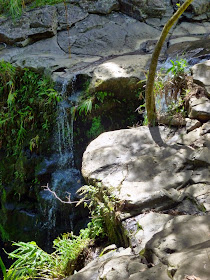
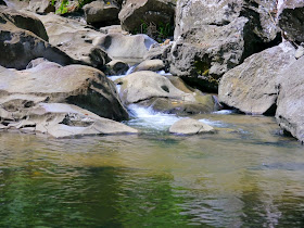
Near mile marker 10 on Route 360 is another hairpin curve that crosses Waikamoi stream on a 12-foot wide bridge built in 1911. There is a very small parking area before the bridge and a spot for a single car at the Hāna end of the bridge. We didn't have time to stop at every scenic spot along the Hāna Highway during our February 2014 visit, so we passed by those that seemed to be overly crowded or didn't have available parking. While we were waiting for oncoming traffic to clear before crossing the bridge, the vehicle at the far end pulled out leaving the spot for us. We pulled in and got out to see what was so popular. The picture below is the view from behind the car at the end of the bridge. A rudimentary trail at the Kahului end of the bridge leads to the falls.
 |
| Lower Waikamoi Falls |
 |
| A closer view of the lower falls |
After reaching the falls, we noticed some people were continuing on up the stream. We heard that there was another, larger waterfall upstream and decided to investigate further.
 |
| The trail climbs above the pool below the lower falls... |
 |
| ...and continues near the top of the lower falls |
 |
| Once the trail reaches the top of the lower falls, it devolves into a scramble through a boulder field |
 |
| To reach the upper falls requires rock hopping across the stream... |
 |
| ...and climbing around or over more boulders... |
 |
| ...and passing a bamboo forest to reach... |
 |
| ...a middle plunge pool |
 |
| A twenty foot cascade feeds the middle pool |
 |
| Additional scrambling leads to this view of the 70 foot Upper Waikamoi Falls |
Waikamoi Falls is likely inside the border of the Ko'olau Forest Reserve. The reserve does not currently have a website. The Hawai'i Department of Land and Natural Resources Maui Forest Reserve website is http://dlnr.hawaii.gov/forestry/frs/reserves/maui-nui/.


No comments:
Post a Comment