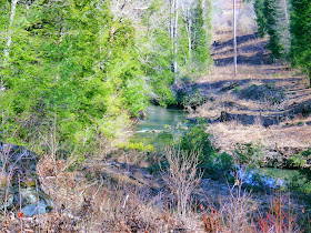
Cumberland Mountain State Park is located inside the city limits of Crossville, Tennessee. The entrance is on US 127 approximately 0.7 miles south of its intersection with TN 68 or 4.3 miles south of the intersection of US70 and US 127. We visited on a sunny day in early March 2014 to hike the Byrds Creek loop trail. The park features activities as varied as swimming in an Olympic-sized pool, golfing, fishing and hiking. Facilities include a restaurant, cabins, a campground and camp store.
The Byrd Creek Trail is listed as 2.1 miles on the park website, but the complete loop is 2.75 miles long. The trail starts by descending stairs at the west end of the dam that forms Byrd Lake. There is about 65 feet of elevation change along the route with the high point near the end at 1780 feet. The trail had some very muddy areas when we visited, but that might only be an issue after spring rains. The trail then follows Byrd Creek downstream. Two other trails intersect the path on this side of the creek. At the first intersection, the blazes change from red to yellow at the official beginning of the Byrd Creek Trail. At the second intersection stay right again to stay on the trail. To cross the creek, turn right on the old paved road. Once across the creek, turn right again to head back up the creek. All of these intersections or turns are well marked. The trail ends behind the visitor center and requires a stroll across the bridge above the dam. Impounding the 50 acre Byrd Lake, this is the largest masonry structure built by the Civilian Conservation Corps anywhere. The concrete structure was completed in 1938 and is faced with local Crab Orchard sandstone.
 |
| Modern visitor center with an information desk, restrooms and staff offices |
 |
| The restaurant is open for lunch year round except Mondays |
 |
| Byrd Creek Dam |
 |
| Byrd Lake |
 |
| Trail stairs lead down to the base of the dam |
 |
| Water spills over the step-faced spillways |
 |
| Trail map |
 |
| The initial portion of the loop is part of the Cumberland Plateau Trail |
 |
| The trail crosses a small stream by rock hopping |
 |
| The trail climbs back up from the small stream |
 |
| An open vista under the power line |
 |
| A muddy section of the trail |
 |
| Typical trail conditions |
 |
| A creek-side view |
 |
| Recent storms have left some trees across the trail |
 |
| Junction kiosk and yellow blaze to the right mark the beginning of the Byrd Creek Trail |
 |
| A bit of white water on Byrd Creek |
 |
| Looking back upstream at a more tranquil portion of Byrd Creek |
 |
| More reflections on Byrd Creek |
 |
| The return path is just across the creek |
 |
| Boy Scout Bridge over an unnamed stream |
 |
| Stream from Boy Scout Bridge |
 |
| The second junction kiosk with the blue blazed Overnight Trail heading to the left |
 |
| Another tree across trail |
 |
| Finding the trail may not be so easy in the summer |
 |
| A sign points the way |
 |
| Byrd Creek and the US 127 bridge |
 |
| Another sign |
 |
| The trail follow the ditch back down to the creek |
 |
| Another tree down |
 |
| Double blazes ensure rock hopping at the correct location |
 |
| The trail moves back to creekside |
 |
| Another typical section of the trail |
 |
| Evidence of maintenance work on the trail |
 |
| The trail follows both banks in this section |
 |
| A few roots can impede progress |
 |
| Another rock hopping stream crossing |
 |
| Another muddy patch on the climb at the end of the trail |
 |
| Trail's end |
 |
| Byrd Lake |
 |
| Byrd Creek Dam |
Admission to the park is free. A fee is charged for swimming and golfing.
The park website is http://tnstateparks.com/parks/about/cumberland-mountain.

Great write up! I just did a post on this trail as well. Very pretty! -Alicia @ www.girlonahike.com
ReplyDelete