Our February 2015 trip to southern California continued with a second day at Santa Cruz Island in Channel Islands National Park. The eastern 24% of Santa Cruz Island is owned and managed by the National Park Service. However, the western 76% of the island is owned and managed by The Nature Conservancy. Access to the western part of the island requires a landing permit issued by The Nature Conservancy. The Nature Conservancy and the National Park Service have worked collaboratively for decades to restore the island. This has included removing feral sheep in the 1980s, removing feral pigs in the 2000s, relocating non-native golden eagles and reintroducing bald eagle chicks in the 2000s.
Even with access limited to the eastern end of the island, there are more trails than we could hike in the short time we had on the island. We departed Ventura on one of Island Packers' catamarans and arrived at Scorpion Anchorage an hour later. We started our hike of the western half of the Cavern Point Loop by walking up the Scorpion Valley past the visitor center and the campground before turning right and heading up a steep ravine. At the top of the hill, we stopped to admire the view before turning right again and climbing up to Cavern Point at an elevation of just over 300 feet. We then retraced our steps back to the intersection with the North Bluff Trail and headed west to the Potato Harbor Overlook which is over 350 feet above sea level. We then retraced our steps back to the trail junction and down the ravine to the visitor center picnic area. From there, I climbed the slightly steeper eastern half of the Cavern Point Loop and returned to the picnic area at the visitor center. This portion of the hike is the second smaller hump in the elevation profile below. Including the short walk from the pier to the visitor center, I hiked over seven miles and my wife hiked about six miles.
Most of Santa Cruz Island is considered a wilderness area. Running water is available at the Scorpion Ranch campground. Vault toilets are located near the visitor center. There is no cell phone coverage on the island and no medical facilities. In addition, there are no fences and guardrails along the top of the bluffs. Numerous signs warn of the dangers of getting too close to the edge of the crumbling bluffs. Due to the number of kayakers, additional signs warn of the dangers of throwing rocks into the ocean from the bluffs. This is a location where parents must be aware of their small children at all times, both for their safety and the safety of others.
 |
| Trail topographic map |
 |
| Trail elevation profile |
 |
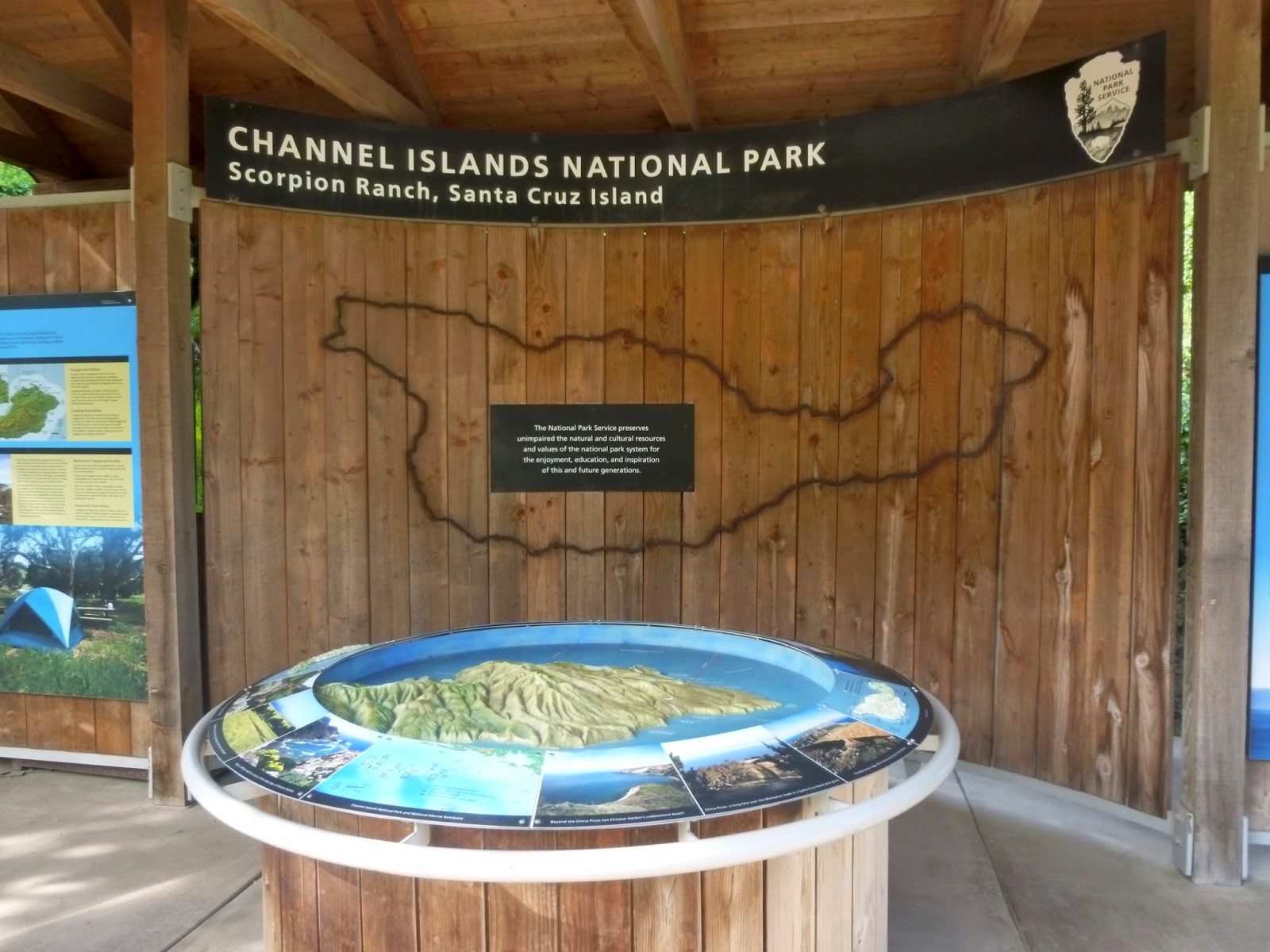
| Visitor Center |
 |
| Trailhead near campsite 22 |
 |
Looking back down the trail
Note the ranger and volunteer housing on the left |
 |
| The trail is well worn |
 |
| View from near the trail junction |
 |
| Black mustard in bloom near Cavern Point |
 |
| Cavern Point |
 |
| Sea caves and kelp beds |
 |
| The interior of the eastern end of the island reaches elevations above 1800 feet |
 |
| Looking northwest near the beginning of the North Bluff Trail |
 |
| Another view of park housing |
 |
| Crumbling bluffs beside Cavern Point |
 |
| There are numerous holes in the bluff |
 |
| Looking back at Cavern Point |
 |
| The trail joins with an old 4x4 road |
 |
| Potholes in the trail |
 |
| More sea caves |
 |
| Rugged bluffs and the western end of Santa Cruz Island |
 |
| Even more sea caves |
 |
| Potato Harbor |
 |
| The small beach in Potato Harbor |
 |
| Shrub trees along the trail |
 |
| Silver lupine along the trail |
 |
| This section of the trail is well maintained |
 |
| Looking back up the trail |
 |
| Island Fox in the campground |
 |
| Looking across Scorpion Valley |
 |
| Eastern trailhead for Cavern Point Loop trail |
 |
| Wooden timbers fail to halt erosion |
 |
| Switchback on the trail |
 |
| Scorpion Beach |
 |
| Another switchback and wooden steps |
 |
| Two islets with Anacapa Island on the horizon |
 |
| Smuggler's Cove Road on the far side of Scorpion Valley |
 |
| Everything to the right of the warning poles is off limits |
 |
| More wildflowers |
 |
| An afternoon view of Cavern Point |
 |
| Raven |
 |
| Kelp can grow up to two feet per day |
There is no entrance fee at Channel Islands National Park. However, the islands are only accessible by private boat or by park concessionaire boats or planes. Island Packers (
http://www.islandpackers.com) has scheduled trips to four of the five islands. San Miguel Island was closed to the public in 2014 due to concerns about unexploded ordinance. The island was used as a bombing range by the U.S. Navy from the 1940s until 1975. Channel Islands Aviation (
http://www.flycia.com/) only has scheduled flights from Camarillo to Santa Rosa Island.
The park website is
http://www.nps.gov/chis/index.htm.