Ramblings and images of some of the wonderful places we've visited
Wednesday, April 17, 2013
Turtletown Falls - Cherokee National Forest
After a few days of rain during the week, the second Saturday in April, 2013, dawned clear and mild, so we decided to hike to Turtletown Falls. Finding the trail head usually isn't a problem for us, but several road signs were missing from the Farner area when we visited. For anyone needing more precise directions than those found on the Forest Service website, I trust the following will prove useful for those southbound on TN 68. From under the railroad at the south end of the curved Hiwassee River bridge, continue 0.8 miles south on TN 68 then make a slight right onto Duggan Road. The Duggan Road sign was missing when we were there, but it is the only right turn in the area. After traveling 0.6 miles on Duggan Road, turn right onto Farner Road for an additional 0.5 miles. Finally, turn right onto an unsigned gravel road that you might mistake for a driveway if you don't notice the backside of a stop sign. After turning onto the gravel road you'll see a sign denoting it as NFSR 1166. Drive about 1.25 miles to the parking area at the end of the road. Just before the parking area, the road crosses a creek without benefit of a bridge. If the parking area is full and you chose to park back up the road, you'll have to wade across the creek before beginning your hike. The trail is Forest Trail 185, but there are no markers to note that either. The trail is the old logging road behind the gate to the right of the parking area and is well marked with white blazes. There were several muddy sections along the trail, but many had flat rocks that were placed in strategic locations to enable quick, dry passage. Due to the muddy areas along the trail, a walking stick can be a useful tool.
The trail starts on an old logging road...
...and closely follows Turtletown Creek
One section was so muddy that a foot bridge has been built
Scouting ahead to find a way around the next wet section
After about 0.7 miles, a footpath heads off to the left while the logging road continues to climb up the hill. There is no junction sign and both the footpath and the road have the white blazes. Take the footpath another 0.3 miles to the base of the falls. There are several steps and some switchbacks along this part of the trail.
The footpath hugs the side of the hill
Small creeks cross the trail
Tree roots are used as natural stairs
Railings help discourage shortcuts on the switchbacks
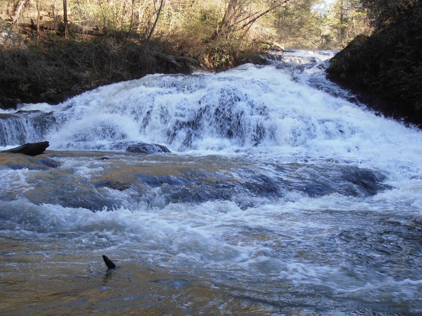
There are a couple of very nice views of Turtletown Falls from across the pool at its base. The mist keeps the rocks and trees damp and slippery, so watch where you step and where you sit.
Turtletown Falls from creekside
Turtletown Falls from the end of the trail
Turtletown Falls from the basin
Retrace your steps along the creek, then continue straight instead of climbing the steps to head toward Lower Turtletown Falls. After 0.7 miles, the footpath ends at the logging road. Turn left and continue another tenth of a mile to the end of the trail at the lower falls.
The footpath between the falls climbs over 150 feet and then descends over 300 feet
The logging road ends as a footpath
Lower Turtletown Falls from the overlook
Lower Turtletown Falls from creekside
To return to the parking lot, you can either retrace your route for 1.8 miles or you can follow the logging road to the top of the ridge to see the Hiwassee River gorge and possibly catch a glimpse of the river through the trees. This section of the river is between Apalachia Dam and Apalachia powerhouse, so most of the river is diverted through an 8-mile tunnel under the ridge. By the way, the name of the dam really is spelled with only one 'p' as opposed to the more customary spelling with two 'p's. The initial climb along the logging road from the lower falls is rather long, so pace yourself. After about a mile, a junction appears. Turn to the right and cross the branch to head back to the parking lot. This return route is just over 2 miles, but is wide enough to walk side-by-side instead of single file. It also avoids the steps and switchbacks of the creekside trail. The forest website is http://www.fs.usda.gov/cherokee. The trail website is http://www.fs.usda.gov/recarea/cherokee/recreation/hiking/recarea/?recid=35074.
John, this is fantastic!!! I'm glad you can do these documented journeys and take others along with you through your pictures and writing. It's beautiful and the locations are awesome. Keep it up. Take care and all the best, Mario Houben


John, this is fantastic!!!
ReplyDeleteI'm glad you can do these documented journeys and take others along with you through your pictures and writing. It's beautiful and the locations are awesome. Keep it up.
Take care and all the best,
Mario Houben