Friday, May 25, 2012

Mammoth Cave National Park


When looking at a list of the 58 national parks, we realized that a quick weekend trip would allow us to visit one that we hadn't previously visited and hadn't really thought much about before.  Even though approximately 2 million people visit Mammoth Cave each year and it is the largest known cave system in the world at 392 miles and counting, it didn't capture our imagination like the Smokies or many of the western parks.  In other words, it wasn't iconic in our minds.  That changed during our visit in mid-May, 2012.  After reading descriptions of several ranger-led tours of the cave, we decided to take the Historic Tour and the New Entrance Tour.  Tickets for each tour are $12 per person.


Historic Tour

Our tour guide for the Historic Tour was Ranger Eric.  Ranger Amanda followed the group to ensure we all stayed together.  Although the tour limit is 120, we only had 46 people.  Since the cave is out of the weather and at a constant 54 degrees Fahrenheit, any season is a good time to visit.  Unless you have school-age children, there is no need to endure the summer crowds.  The tour starts by walking down the road from the visitor center to the natural or historic entrance to the cave.  Tours have been offered via this entrance since 1816.  Once near the entrance, we had a safety briefing and descended a set of about 100 stairs into the cave.  A steel structure has been erected inside the cave to control human visitation, but still allow air to flow in or out of the cave.
Entrance Stairs
The passageway is of the size one would find in a convention center and is called the Main Cave.  This portion of the trail is constructed of concrete pavers with wooden kick-boards along both sides.  This is a dry portion of the cave, so there are no formations like those found at Carlsbad Caverns or Lehman Cave.  One of our first stops was at the Rotunda Room.  This room is about 3/4 of an acre or over 30,000 square feet with a height of about 40 feet.  During the War of 1812, about 80 slaves used this room for a portion of their work in converting cave dirt into saltpeter that was then shipped east to make gunpowder. Due to the constant temperature and low humidity of the cave, the remains of their wooden piping and leaching boxes can still be seen as they were abandoned.  The spots visible in the picture are due to the large amount of dust in the air.
Ruins of saltpeter mining in the Rotunda
At the Rotunda, we stayed to the left to walk down Broadway with an average width of 60 feet and height of 40 feet.  There are several stairs in this area and some elevated wooden walkways.  Next, we stopped at a large slab of rock called the Giant's Coffin.  The rock is 50 feet long, 20 feet wide and 16 feet high.  Just to give us a feel for total darkness, Ranger Eric turned off the electric lights for a few moments.  Then, he used a lantern to give us an idea of how the early visitors saw the cave.  In case the lights actually went out, both rangers had flashlights to guide us out or to a cache of additional battery powered lights.  
Giant's Coffin
We then walked behind the Giant's Coffin and down some awkward stairs into the aptly named Dante's Gateway that reminded us of a slot canyon.  We skirted a couple of pits before coming to Bottomless Pit which is 105 feet deep below the trail and another 60 feet above it. Stephen Bishop, a slave guide, was the first person known to cross Bottomless Pit.  He allegedly did this by dragging a cedar tree into the cave and shinnying across it with a lantern in his teeth.  He discovered all the areas we would visit between Bottomless Pit and Mammoth Dome.  Today, there is a steel bridge with sturdy wire mesh sidewalls up to the stainless steel handrails.
Bottomless Pit
Once beyond the pits, we arrived at Fat Man's Misery.  Stephen Bishop and his early tourists had to crawl through this area, but the sand has since been excavated from the narrow winding channel to allow us to walk through in a sideways, slightly stooping manner.  
Fat Man's Misery
Exiting the cramped, narrow passage, we came to Great Relief Hall.  It is currently used as a location for the the group to reconvene after the single-file passage.  Our next stop was to view historic graffiti and learn about how it was created with lantern or candle smoke.  
Historic Graffiti
Flowstone in Mammoth Dome
After crossing through and over a boulder strewn section, we came to 192-foot high Mammoth Dome.  Stephen Bishop considered Mammoth Dome his greatest discovery.  There is a massive flowstone formation in this room.  Here we climbed a steel structure with 155 stairs and several landings. 
Stair Tower
Mammoth Dome from the Stair Tower


At the top of the stairs, we entered a passageway called Little Bat Avenue that led back to the Rotunda and then out the Main Cave to the historic entrance.  
The Rotunda...again 

Daylight!
Once at the top of the stairs, everyone is required to walk across the bio-security mats in an effort to prevent the spread of White-Nose Syndrome to additional bats.


Surface Trails

Between cave tours, we drove back out the Cave City Road to the entrance sign and strolled along the 0.1 mile Sand Cave Trail elevated boardwalk.  This pleasant walk has several interpretive signs to commemorate the failed rescue attempt of Floyd Collins in 1925.  
Sand Cave Boardwalk
Sand Cave
Back at the Visitor Center, we walked the 0.3 mile wheelchair accessible Heritage Trail to Sunset Point.  Bearing left at the split in the trail, we also chose to walk the 0.1 (or 0.2 depending on the signs) mile gravel path to the Mammoth Dome Sink scenic overlook.  Other than a bench marking the end of the trail, we didn't find anything that resembled an overlook.  Back on the main trail, we paused at Sunset Point until it started raining.  The combination of a dense forest canopy and a short duration rain event left us damp but not soaked.  
View down the Green River valley from Sunset Point


New Entrance Tour

This tour requires a short bus ride going and coming.  From the drop off point, we walked down into the sinkhole and then through a door into a short tunnel used as an airlock.  After going through the second door, we had the opportunity to peer down into the vertical shaft, or pit, that we would descend.  A series of 280 stairs led us down this pit and into the cave.  

The entrance pit
The trail then traverses a few narrow passageways in an area called the Subway before opening into a large room for this part of the cave called Grand Central.  There are a series of bench seats where we could rest for a minute while listening to Ranger Amanda tell some of the stories of George Morrison, the oilman who created the New Entrance in the 1920s.  There are a number of exits from the aptly named Grand Central.  During the storms that left Nashville flooded a year ago, this room was almost 30 feet underwater.  There is still one bench missing from that flood.
Grand Central
Our tour headed uphill from here to another, larger room with more benches called the Fairy Palace due to the very small stalactites on the ceiling.  
Uphill route out of Grand Central
Small stalactite formation that gave the Fairy Palace its name

From here we continued on to the Frozen Niagara area and chose to descend the additional stairs into the Drapery Room that is below and behind Frozen Niagara.  On the way out, we saw many additional formations.  Some were so close to the trail that a mesh screen has been installed on the right side to keep people from touching the active formations.  
Frozen Niagara
Drapery Room
Ceiling of the Drapery Room
There are a number of lifeforms in the cave from eyeless, translucent fish to blind cave crickets.  We passed a colony of the crickets clinging to the low ceiling on the way out.  Some people might want to consider wearing a hat.  We exited by way of the Frozen Niagara Entrance.  From here, we boarded the bus and rode uphill past the New Entrance and back to the Visitor Center.

Future Plans

On our next trip, we plan to take the 4-hour Grand Avenue Tour.  Tickets for this tour are currently $24 each.  Hopefully, the rest of the Visitor Center renovations will be complete as well.  The portion that is open is very well done.  In addition, there are miles of bike trails to explore using one the rental bicycles from the camp store.


The park website is http://www.nps.gov/maca.

Monday, May 21, 2012

Blue Ridge Parkway

French Broad River
A drive on the Blue Ridge Parkway is a great way to unwind and relieve stress.  The parkway is a 469-mile scenic byway connecting Shenandoah and Great Smoky Mountains National Parks.  In late April 2012, I drove the short section from Asheville, NC south to Mt. Pisgah.  I would have driven further, but late afternoon thunderstorms were developing and enveloped the mountain in fog.  Spring was in full force in the valley, but winter was still clinging to the top of the mountain.
Bad Fork Valley
Mountains and Clouds above Bad Fork Valley
View from Beaver Dam Gap
Clouds obscure Stony Bald
Big Ridge (elev 3820 ft)
Hominy Valley
Mill River Valley
Stairs from the parking lot to Buck Springs overlook
Winter persists on the trail to Buck Springs overlook
Viewing benches at Buck Springs overlook

The park website is http://www.nps.gov/blri.

Thursday, May 17, 2012

Fall Creek Falls State Park

Fall Creek Falls
 A quick day trip in late April 2012 to Fall Creek Falls State Park in Van Buren County on the eastern rim of the Cumberland Plateau yielded a refreshing hike and a few pictures of one cascade and four waterfalls.  Just behind the Betty Dunn Nature Center is the 45 foot high Cane Creek Cascades.  Immediately downstream is 50 foot wide Cane Creek Falls which falls an additional 85 feet into an amphitheater pool.  Also falling into the same pool is the 125 foot Rockhouse Falls.  The best views of both falls are from a trail about 0.4 miles beyond the suspension bridge.  The trail includes numerous stairs just beyond the bridge.  Continue hiking for another half mile or so to the Fall Creek Falls parking lot and overview.  Parts of this trail are smooth forest and others are strewn with rocks and even boulders.  From the overlook, it is a short hike down over 250 feet to the pool at the base of the falls.  There is a second waterfall of Coon Creek into this basin as well.  The hike back up seems much longer for some reason and then there is the additional mile hike back to the Nature Center.


Cane Creek Cascades

Easy part of the trail

Rockhouse Falls


Cane Creek Falls

Rocky part of the trail
Fall Creek Falls from Overlook

Part of the trail down to the falls

There's a trail in there somewhere
Fall Creek Falls from the bottom

Only a trickle remains of Coon Creek Falls

Resting before the return climb

At least there are handrails in a few places

Finally back to the suspension bridge

Sunday, May 13, 2012

Great Basin National Park

Unless you live in or near Ely, Nevada, a trip to Great Basin National Park requires a bit of planning.  We visited during spring break of 2012.  The nearest major airport is in Salt Lake City about 240 miles from the park.  In order to see more of the country, we chose to return via a different route.  Our trip to the park involved driving south on I-15 to Nephi, then west on US 6 and US 50.  
Along this route, Delta is the last town large enough to have traffic lights before arriving at the park.  We stopped for gas and groceries.  We stopped to take some pictures along the way (of course!) and noticed this snow-capped mountain behind us to the east.  
As you might expect, the sagebrush and high clouds seem to go on forever.  While vast areas were open range, there were also numerous fences as well.  There must be something valuable out there to justify the miles of fences that have to be maintained.


Route 6 parallels the Sevier River for several miles and then skirts the salt flats of Sevier Lake.  The wind had picked up quite a bit by the time we saw the salt flats and produced a whirlwind or dust devil that could be seen for miles.  


We had sagebrush to the left of us, to the right of us, ahead of us and behind us.  Try to imagine trying to cross this territory on a horse with only the water and food you brought with you.

Crossing one ridge led us to yet another basin and another ridge.

After crossing a couple of ridges, we finally saw Wheeler Peak at an angle...

...and then head on.
The main attractions at Great Basin are Lehman Caves, 5000 year old bristlecone pine trees, Wheeler Peak, the darkest night skies in the continental US, hiking and scenic drives.  Unfortunately, March is too early in the season for hiking to the bristlecone pines or even taking the scenic drive up the flank of Wheeler Peak, so we’ll have to plan those activities for another visit.  Upon arrival at the park, we stopped at the Lehman Cave Visitor Center to confirm our tickets for the Lehman Cave tour and discovered that we had purchased the only three tickets sold for the tour that day.  We met a ranger who asked about my accent and mentioned he has family in the Tri-Cities area of northeast Tennessee.  In further discussion, we found that he had recently been stationed at a remote native village on the edge of the Wrangell-St Elias National Park for a year, collecting ice samples and doing other field work regarding the glaciers and ice fields in the area.


Even though we were around 6800 feet in elevation, it was warm enough that we were able to have a nice, but windy, picnic at the designated picnic area before touring the cave.   


We had chosen to take the 1:00 pm (Pacific Time) Grand Palace Tour which costs $10.00 per person, lasts about 90 minutes and covers 0.6 miles.  The tour visits all the areas open to the public, including the Gothic Palace, the Music Room, the Lodge Room, Inscription Room and the Grand Palace sections of the cave.  The natural entrance required descending into the cave via a rope ladder.  A new entrance and exit were excavated to allow easier access to the cave.  After our safety briefing, the ranger unlocked the door and turned on the lights in the access tunnel.  At this point, another couple joined our tour for a total of five tourists and one ranger.


Looking up revealed an intricate display of flow stone, stalactites, cave popcorn and other formations.


Cave Bacon


Parachute Shield


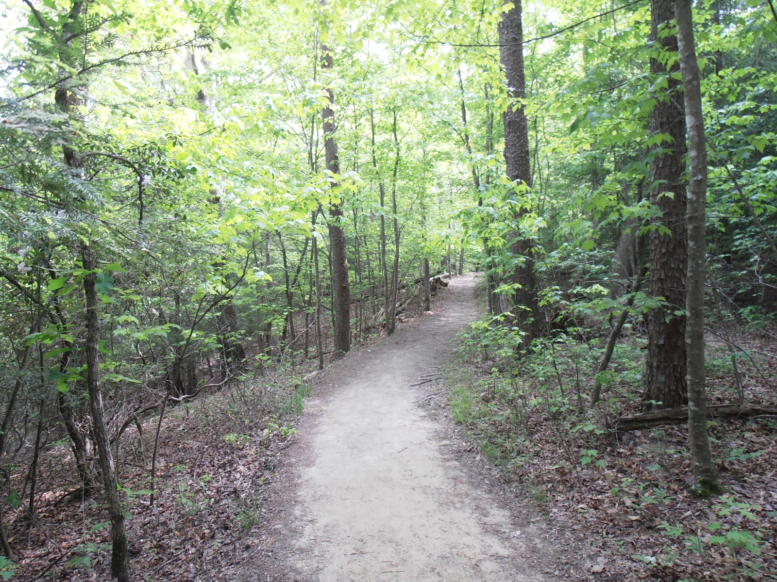
After our cave tour, we decided to walk the short 1/3 mile Mountain View Nature Trail loop through the Pinyon-Juniper forest above the visitor center.  As suggested on the Park website, we borrowed the trail guide from the visitor center that described the geology and ecology of the area.


Our route back to Salt Lake City included continuing west on US 50 another hour to an overnight stop at the LaQuinta Inn in Ely, Nevada.  While US 50 is termed "The Loneliest Highway in America", it is a beautiful route through the Basin and Range area of eastern Nevada.  After dark, we drove back east on US 50 until we had crossed the ridge and found a pullout where we could park.  We then marveled at the vast number of stars visible in the dark sky.


While in Ely, we visited the Nevada Northern Railway Museum and had a reasonably priced, delicious lunch at the All Aboard Cafe & Inn.  We left town heading north on US 93 with a full tank of gas as the next gas station was well over 100 miles away in West Wendover.  Merging onto I-80 East, we crossed the Bonneville Salt Flats and drove into Salt Lake City.  The loop involved about 550 miles and over 10 hours in the vehicle.


The park website is at http:/www.nps.gov/grba/index.htm.