Monday, October 15, 2012

Lake View Drive GSMNP


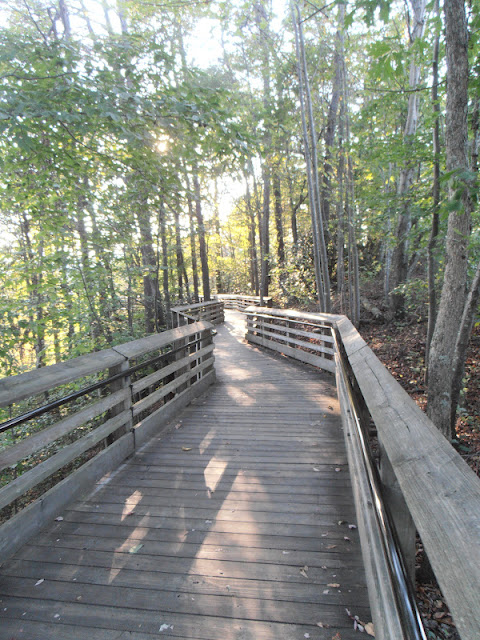
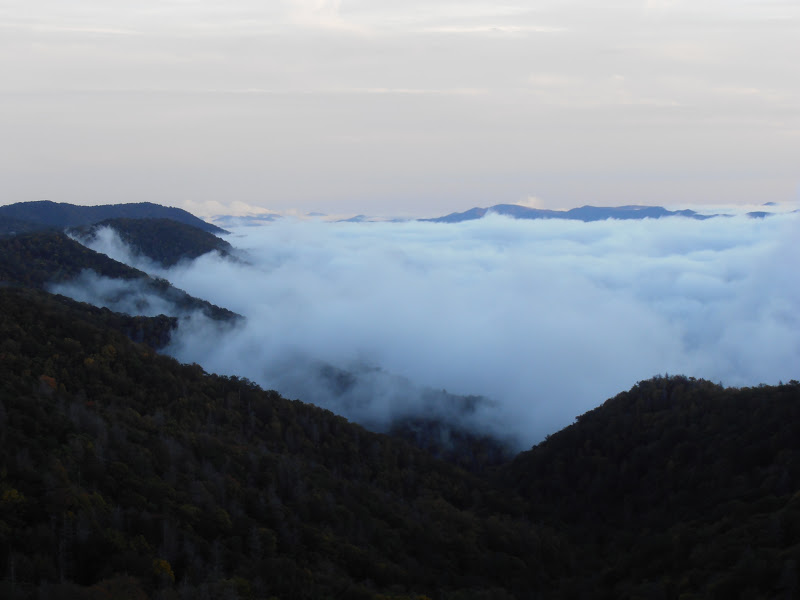
In early October, 2012, we finally made time to visit an area of the park that has been steeped in controversy for decades.  When the 480 foot high Fontana Dam was completed during World War II, several towns upstream were submerged under the rising water.  Highway 288 from Bryson City to the old town of Fontana was also submerged.  In 1943, the Department of the Interior made an agreement with Swain County to build a new road through the park from Bryson City to Fontana Dam to replace the old highway and to allow access to several cemeteries.    In 2010, another agreement was signed that voided the 1943 agreement, and paid $52 million to Swain County in lieu of completing the road.  Only the first six miles were ever completed, while the remaining 26 miles of the proposed road will never be built.  The estimated cost to complete the road was several hundred million dollars.  The road provides some great views of the Tuckasegee River embayment of Fontana Lake.

Fontana Lake

Evaporating clouds reveal the mountains

Permanent end of the road

1200 foot tunnel beyond the bollards

The pavement continues beyond the tunnel

The real end of the road

The road becomes the aptly named Lakeshore Trail

Not everyone was satisfied with the new agreement

The park website is http://www.nps.gov/grsm/index.htm.

Sunday, October 14, 2012

Oconaluftee River Trail GSMNP


This trail is a pleasant walk from the Oconaluftee Visitor Center to the edge of Cherokee, NC.  We walked to town and back on the first weekend in October, 2012.  Since I took most of the pictures on the way back,  I’ll narrate the walk from Cherokee upstream to the visitor center.  The interpretive signs along the trail are written in both English and Cherokee and retell several of the ancient spiritual stories of the Cherokees.  The text of the trailhead sign is as follows:

The 1½ mile (one-way) trail follows the Oconaluftee River from the edge of the Qualla Boundary upstream to the Mountain Farm Museum and Oconaluftee Visitor Center in Great Smoky Mountains National Park.
As you walk the river trail you will read about the Cherokees’ spiritual relationship with this place they call home.  As long as they can remember, the Cherokees have nurtured living things.  They have accepted the sacred responsibility of being caretakers of the earth, which provides everything needed for life.
Great variations in mountain topography create an astounding diversity of plants, animals, soils, and climates in a relatively compact area.  Great Smoky Mountains National Park protects the diversity of life sheltered within the mountain slopes that the Cherokees hold in great honor and respect.
“The Great Smoky Mountains are a sanctuary for the Cherokee people.  We have always believed the mountains and streams provide all that we need for survival.  We hold these mountains sacred, believing that the Cherokee were chosen to take care of the mountains as the mountains take care of us.” – Jerry Wolfe, Cherokee elder
The trail begins at the end of the sidewalk on Tsali Boulevard (U.S. 441) and almost immediately heads into the woods.  A sturdy footbridge has been constructed to cross the one drainage area encountered on the trail.  The only road crossing is on a Bureau of Indian Affairs road that connects U.S. 441 with Big Cove Road on the other side of the river.  The crosswalk is not well marked for motorists and it is near the intersection with U.S. 441, so caution is advised.  The trail passes under the Blue Ridge Parkway as the parkway crosses the river.  The turns away from the river at the Mountain Farm Museum and follows the fence along the edge of the meadow to the visitor center.


Oconaluftee River Trail

Rattlesnake Mountain

Footbridge

Old Newfound Gap roadbed

Early autumn color


Leaves on the trail

The trail hugs the riverbank just south of the Blue Ridge Parkway

The river converges after skirting an island
just upstream of the Blue Ridge Parkway

Calmer water beside the island

A different type of fall color

The river is seldom out of sight from the trail

Meadow between the Blue Ridge Parkway and
the Oconaluftee Visitor Center

Mountain Farm Museum

Oconaluftee Visitor Center

Bicycles are allowed on this trail, although we didn't see any.  Dogs are also allowed on leashes of six feet or less.

The park website is http://www.nps.gov/grsm/index.htm.

Saturday, October 13, 2012

Bald River Falls


Bald River Falls is one of our favorite places.  We stopped here in early October, 2012 as the leaves were just beginning to change colors.  My previous post about the falls is available here. The falls are in the southern section of the Cherokee National Forest and accessible by way of a paved U.S. Forest Service road off of the Cherohala Skyway.


The Cherokee Forest website is http://www.fs.usda.gov/cherokee.

Friday, October 12, 2012

Newfound Gap Road GSMNP


Fall is a special time of year in the Great Smoky Mountains National Park and we try to visit often.  In early fall of 2012, many of our opportunities to visit the park were on rainy days, so we chose to drive instead of hike.  One of the longer roads in the park is the Newfound Gap Road (US 441) between Gatlinburg, TN and Cherokee, NC.  There are several scenic overlooks and pullouts along the road.  Some of my favorites are the Morton Overlook (13.0), an unnamed overlook that I call "Sidewalk Overlook" (17.0) because the best views are from the sidewalk, the Webb Overlook (17.8) and another unnamed overlook that I call "Lone Tree" (18.7) due to the solitary tree at the lower end of the parking area.  Further down the Oconaluftee Valley are several pullouts along the river.


Newfound Gap Road from Morton Overlook (MP 13)


The overlook at MP 17 doesn't have an official name,
but it does have this sidewalk, so I call it "Sidewalk Overlook"


Fall colors from "Sidewalk Overlook"

Ridgelines and fog from "Sidewalk Overlook"

Mountains and storm clouds from "Sidewalk Overlook"


Clouds linger at Webb Overlook (MP 17.8)


Autumn colors on ridge behind Webb Overlook


The "Lone Tree Overlook" (MP 18.6) provides a view
across the Oconaluftee Valley to the northeast.


Clouds receding up the Oconaluftee Valley from "Lone Tree Overlook"

Oconaluftee River from the Kephart Prong Trailhead (MP 23.6)


Oconaluftee River from roadside pullout (MP 26.7)

Oconaluftee River from roadside pullout (MP 26.7)

The park website is http://www.nps.gov/grsm/index.htm.

Saturday, October 6, 2012

New River Gorge National River


Returning home from Cuyahoga Valley National Park, we chose a route through West Virginia.  We made a slight detour to cross the New River Bridge and then view the bridge from the upper and lower overlooks at the Canyon Rim Visitor Center.  When the bridge was completed in 1977, it was the longest single-arch steel span bridge in the world.  It is also the third-highest bridge in the United States behind the Royal Gorge Bridge over the Arkansas River in Colorado and the Mike O'Callaghan – Pat Tillman Memorial Bridge that spans the Colorado River downstream of Hoover Dam between Arizona and Nevada.

The visitor center is located at the northeastern (highway north) end of the bridge.  The upper overlook is wheelchair accessible and is just 100 feet or so from the parking area via a sidewalk and connecting boardwalk.  The lower overlook is reached by a series of wooden stairs and connecting walkways that descend approximately 200 feet below the rim of the gorge.

Canyon Rim Visitor Center

Elevated boardwalk

The New River Bridge carries the four lanes of US 19 for 3,030 feet across the gorge.  The roadway is 876 feet above the river and reduced travel time from 45 minutes to less than one minute.  It was constructed by the American Bridge Division of US Steel and utilized a steel alloy called COR-TEN® or weathering steel that eliminates the need to periodically paint the structure.  When exposed to the elements, the steel forms a protective rust-like surface coating that protects the rest of the structure.  

New River Bridge from the lower observation deck

The old Fayette Station bridge

Early evening mist highlights bridge shadows

While we only had time for a brief stop on this trip, we are planning a more extensive visit to the park to take advantage of some of the many biking, hiking, and scenic driving opportunities.

The park website is http://www.nps.gov/neri/index.htm.

Friday, October 5, 2012

Kenneth J Sims Park, Euclid, Ohio


After leaving the James A.Garfield home site, we decided to drive over to Lake Erie.  While driving along Lake Shore Boulevard, we came across the thirty acre Kenneth J. Sims Park in Euclid, Ohio.  This municipal park provides lake access, a popular disc golf course and bird watching viewpoints.  In addition, a picnic pavilion, public restrooms and the Albert W. Henn historic mansion are on the site.  When we visited in September, 2012, the restrooms were in need of cleaning and renovation, but the park grounds were well maintained.  


Albert W. Henn mansion

Lake side of mansion


Beach on Lake Erie

Eastlake Generating Station, epicenter of the 2003 blackout

Picnic pavilion


Stalking squirrel

The park is open from dawn to dusk.  

There is not a specific website for the park, but the city website is http://www.cityofeuclid.com/.
The Henn mansion website is http://www.hennmansion.org/.