Wednesday, August 13, 2014

Interpretive Center - Cahokia Mounds State Historic Site


Our July 2014 visit to the St. Louis area continued with a visit to the ancient Cahokia Mounds in Collinsville, Illinois.  Located just eight miles directly northeast or ten miles by road from the Gateway Arch, this UNESCO World Heritage Site is administered by the Illinois Historic Preservation Agency.  The following paragraph is quoted from the World Heritage page of the UNESCO website:
Cahokia Mounds is the largest and earliest pre-Columbian settlement north of Mexico. It was occupied primarily during the Mississippian period (800-1350), when it covered over 1,600 hectares (3,950 acres) and included some 120 mounds. It is the pre-eminent example of a cultural, religious, and economic center of the Mississippian cultural tradition, which extended throughout the Mississippi Valley and the south-eastern United States. This agricultural society may have had a population of 10,000-20,000 at its peak between 1050 and 1150. Cahokia is an early and exceptional example of pre-urban structuring.
About 2,200 acres and 80 mounds of the ancient city are included in the historic site.  The large Interpretive Center houses an information desk, site model, shop, snack bar, auditorium, theater, numerous exhibits, administrative offices and restrooms.  Ample paved parking is available adjacent to the center.  An excellent fifteen minute orientation film, Cahokia: City of the Sun, provides an overview of what is known about the Mississippian culture and speculates on what may have caused the rapid decline of the civilization.

While the overall site could use some additional signage, this is a very impressive interpretive center for such a significant site.  Hopefully, additional archeological excavations will further enhance our understanding of the Mississippian culture that flourished here a millennium ago.

Interpretive Center from the parking area

A large site model is prominently displayed near the shop and information desk

Numerous exhibits interpret the civilization

The culture spread from the Great Lakes to the Gulf and the Atlantic

The city was larger than London in 1250 AD

A model of the largest prehistoric structure in North America

A model of Woodhenge

Building a sweat lodge

The rear of the Interpretive Center overlooks the Grand Plaza

Entrance to the site is free, but a suggested donation of $7 per adult, $5 per senior, $2 per child or $15 per family.

The historical site website is http://cahokiamounds.org/.

Thursday, July 31, 2014

Old Courthouse - Jefferson National Expansion Memorial


Continuing our July 2014 visit to St. Louis, we spent some time at the Old Courthouse two blocks west of the Gateway Arch.  The historic building is part of the Jefferson National Expansion Memorial.  The building houses offices, a bookstore, a small theater room, restrooms and four wings of St. Louis history on the main floor as well as two restored courtrooms on the second floor.

This is the building where Dred Scott sued for his freedom from slavery.  A 20 minute film provides context for the case.  While he won his freedom during the second trial in 1846, the United States Supreme Court ruled in 1857 that African Americans could not be citizens and thus Scott had no standing to sue.  The 7-2 ruling has been cited as one of the worst decisions made by the court as it ignored many precedents in trying to craft a ruling that would actually settle the slavery issue.  Instead, the ruling became one of the catalysts for the American Civil War.

The Old Courthouse

The copper-clad dome was based on the dome in St. Peter's Basilica in Rome

This statue of Dred and Harriet Scott was unveiled in 2012

East entrance to the courthouse

Looking up at the three galleries surrounding the dome

A model of the 1851 courthouse showing the included 1828 building

Lookup up through one of the winding staircases

One of two restored courtrooms

1904 St. Louis Motor Carriage automobile

Gateway Arch from a courthouse window

There is no entrance fee to visit the Old Courthouse.

The park website is http://www.nps.gov/jeff/index.htm.

Wednesday, July 30, 2014

Gateway Arch - Jefferson National Expansion Memorial


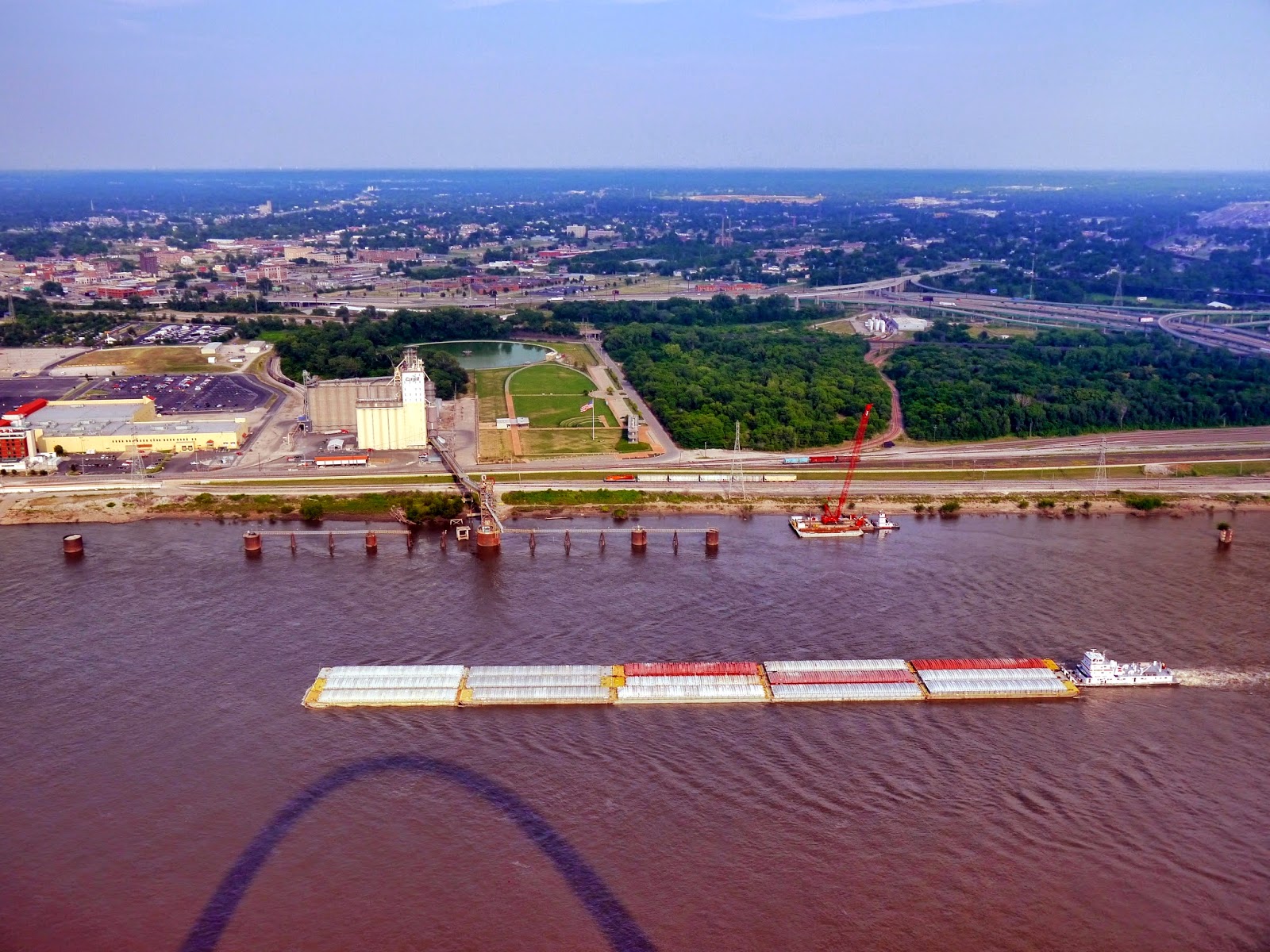
In late July 2014, we headed to St Louis, Missouri for a short vacation.  Our first stop was at the Gateway Arch on the grounds of the Jefferson National Expansion Memorial.  The memorial includes the original town site on the banks of the Mississippi River.  The arch is 630 feet high and 630 feet wide, making it the tallest man-made monument in the United States.  Ground was broken in 1959, the foundations were begun in 1961, construction on the arch itself began in February 1963 and the keystone was set in late October 1965.  Additional work on the museum, visitor center and tram delayed the public opening until summer 1967.  Although an actuarial firm predicted that thirteen lives would be lost during construction, there were no fatalities on the project. 

We bought tickets to both of the movies shown at the memorial as well as tram tickets for a ride to the viewing area inside the top of the arch.  We watched Monument to the Dream in the Tucker Theater.  This 28-minute film is an excellent documentary of the construction of the Gateway Arch.  Be aware that the footage was shot in the early 1960s and is not the same quality as more recent productions.  We also watched the 42-minute Lewis and Clark: Great Journey West in the Odyssey Theater.  This 2002 release from National Geographic provides a live-action overview of the multiple year journey of the Corps of Discovery.  For those who prefer watching on a small screen or cannot make a trip to St Louis, low resolution versions of both films are currently viewable on the Internet.

Besides the two theaters, the visitor center also houses the impressive Museum of Westward Expansion with exhibits and artifacts of the past two centuries as well as a bookstore, replica General Store, information desk and restrooms.

Although the park recommends buying movie and tram tickets online to avoid summer sellouts, neither theater was very crowded and tram tickets were available for admittance to the queue within 30 minutes almost all day.  The tram is operated by the Bi-State Development Agency or Metro.  This is the same organization that operates the light rail and bus system in the area.  If our tram experience is typical, the ticketing system needs to be updated.  From the stated time on the ticket until we reached the tram was one hour.  Each leg has its own tram system and waiting lines.  The tram consists of eight pods capable of holding five people and operates on a 10 minute cycle.  This provides an opportunity for 240 people per hour per leg to visit the observation level.  Thus approximately 240 people were already in line before we were admitted to the queue.  Because I haven't heard of many complaints about the wait and after talking with a ranger after our visit, I suspect that a mechanical problem may have caused the tram to have been shut down or slowed down earlier in the day creating the backup.  In any event, plan for a long wait and note that there are no water fountain or rest room facilities in line or at the top. At the top, sixteen small windows on each side provide magnificent views of downtown St Louis to the west and the Mississippi River and Illinois plains to the east.

Gateway Arch from the top of parking garage

The arch was constructed in numerous sections with an outer stainless steel layer

The stainless steel skin panels of the arch are clearly visible

Gateway Arch from the Memorial Drive sidewalk

Directly under the arch near the entrance to the visitor center

Tram doors and stairs to the viewing area

The equilateral triangular shape of the arch allows visitors to see under the arch itself

Downtown St Louis

The Old Courthouse is part of the Jefferson National Expansion Memorial

Busch Stadium

The Poplar Street Bridge carries traffic from both I-55 and I-64

The East St Louis, Illinois riverfront

The Eads Bridge with the Martin Luther King Bridge in the background

Due to high river flows, the riverboat was not in operation during our visit.  Riverboat tickets are $14 for adults and $8 for children ages 3 to 15.  Tram tickets are $10 for adults and $5 for children.  Movies are $7 per adult and $2.50 for children.  Note that there are two theaters showing two different movies.  Each adult tram or movie ticket includes a $3 entrance fee which is waived for holders of the $80 America the Beautiful Annual Pass, $10 America the Beautiful Senior Pass, or the free America the Beautiful Access Pass, Volunteer Pass and Military Pass.  Parking at the Metro operated garage at the north end of the memorial is $6 per day regardless of the length of time.  The Arch-Laclede's Landing MetroLink light rail station is just north of the garage in the base of the Eads Bridge.

The park website is http://www.nps.gov/jeff/index.htm.

Saturday, July 26, 2014

Third Creek Greenway


The Third Creek Greenway follows Third Creek 4.5 miles upstream from Neyland Drive through Tyson Park to Forrest Park Boulevard in Bearden.  It connects with the Neyland Greenway at its eastern terminus and with the Bearden Village Greenway at its western end.  The route is paved and includes several bridges over Third Creek and its tributaries.  Although there are a few small hills to climb, the route is fairly flat for Knoxville.  We biked the route in mid-July 2014.

Athletic fields, Alcoa Highway and the Tower at Morgan Hill

The greenway and Third Creek pass under Kingston Pike

Third Creek

Interstate 40 spans the creek, the greenway and Tyson  McGhee Park Street

Picnic pavilion at Tyson Park

Playground equipment at the park

Lighted tennis courts

Crossing East Third Creek

Near the side trail to Safety City

Crossing Third Creek on a shingled bridge

The trail provides lots of shade along the creek

Crossing Third Creek for the third time

The hills and curves increase as the greenway approaches Bearden

Norfolk Southern spans Third Creek and the greenway with this masonry arch bridge

There is no fee to access the greenway. While the city and its wastewater utility are making improvements, be aware that Third Creek is posted as not suitable for human contact.

The greenway website is http://www.cityofknoxville.org/greenways/thirdcreek.asp.