Kendall Lake is in the Virginia Kendall Unit of Cuyahoga Valley National Park. It is located just south of Truxell Road and west of the Ritchie Ledges area. The lake was created by the Civilian Conservation Corps in the 1930s. There are several trails in this area as noted in the detailed map available online or at most visitor centers.
Since we had already biked quite a bit on this day, we decided to tackle the easy Lake Trail around Kendall Lake. Our first task was to find the trail head. We walked over to the Lake Shelter shown above but didn't find a path beyond the shelter. However, we did find several geese on the lawn.
 |
| Geese on the lawn at Kendall Shelter |
Retracing our steps back to the parking lot, we chose to take a wide trail up into the woods until we came to a signed junction or we had walked a while. When we came to a junction, it did note the location of the Lake Trail as well as the Cross Country Trail. We decided to hike clockwise around the lake and started out. After just a few minutes, we came to this underpass or tunnel and wondered why it was there. On the far side, we found an interpretive sign that showed we had just walked under the route of the toboggan chute or slide that was built in 1939. The tunnel was built to allow trail access without having to walk across the toboggan slide. According to the sign, the slide was removed in 1990.
 |
| The "Tunnel" |
Continuing on around the lake, we saw trails leading across open fields and over the hills to the south and west. The first few of these are connecting trails through the Kendall Hills. The last of the trails is a 3.3 mile loop called the Salt Run Trail which we saved for another visit.
 |
| An intersecting trail heads over the hill |
One odd thing to me about the Lake Trail is that the lake is only visible from about one third of the trail. The rest of time the trail meanders through the hills and wetlands.
 |
| Kendall Lake and Shelter |
 |
| Kendall Lake with the first hint of fall colors |
Kendall Lake is impounded by means of an earth dam with a concrete core. The trail crosses the dam and provides a nice view of Salt Run as it emerges from the tailrace of the dam.
 |
| Salt Run emerges from the tailrace |
 |
| Looking back at the crest of the dam |
While the trail map shows an elevation change of 20 feet, it didn't mention that it was by way of a flight of stairs just beyond the dam.
 |
| Two dozen timber steps in this flight of stairs |
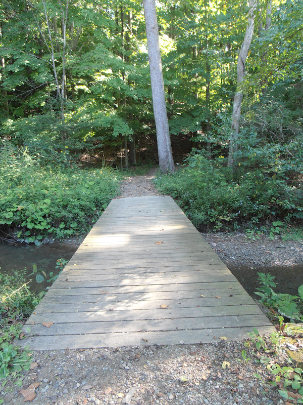
Once the trail crossed the entrance driveway, it headed into a canebrake and then crossed one of the tributary creeks before heading back up the hill south of the parking lot.
 |
| Tributary creek |
 |
| Bridge over the creek |
We easily found the wide connecting trail leading back to the parking lot. The trail is a one mile loop and took us about an hour, including my photo stops. Some additional signage near the parking lot denoting the trail system would be helpful, but it is possible that it was temporarily removed while a contractor resealed the parking lot. Overall, this was a very pleasant stroll around the lake.
The park website is http://www.nps.gov/cuva/index.htm.


No comments:
Post a Comment