Brandywine Falls is the largest waterfall in Cuyahoga Valley National Park and one of the largest in Ohio. It is located on the east side of the park, less than a mile and a half northeast of the Boston Store Visitor Center. However in a classic example of "you can't get there from here", it is about a 10 minute drive of over 4.5 miles by road. The directions provided by the park service were excellent, so we had no problems finding the large parking area. A kiosk and vault toilets are adjacent to the parking area. At the northwest corner of the parking area, a set of concrete steps leads to a choice of a gravel trail down the old Stanford Road or a boardwalk and stairs to either the upper or lower viewing platform. We chose to visit the falls first and then hike the Brandywine Gorge Trail on another day. The upper viewing area is above the top of the falls at the site of an abandoned grist mill and later an appliance manufacturer. The boardwalk is wheelchair accessible to a view of the falls near the upper overlook, but has stairs down to the abandoned mill area and a closeup view of the falls. Since the ruins of the mill and appliance manufacturer are part of the cultural history that the park is attempting to preserve, it is doubtful that the stairs would ever be eliminated. The round trip distance from the parking lot to the falls is about a quarter mile.
 |
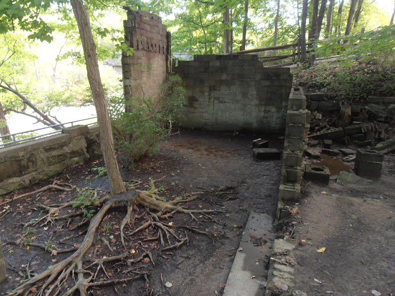
| Remains of Champion Electric Company appliance manufacturer |
 |
| The falls from the upper viewing level |
 |
| Brandywine Creek from the trail bridge immediately above the falls |
The falls drop about 60 feet and the volume of water is highly variable. The lower viewing platform is actually only about halfway down the gorge and not at the bottom of the falls. If you want to take any video of the falls, I'd suggest doing it on a school day when there are fewer visitors.
 |
| Boardwalk trail to lower viewing platform |
 |
| Stairs, stairs and more stairs |
A storm the previous day made up for the fact we were visiting during the late summer dry season. The following pictures demonstrate how quickly the flow rate can change.
 |
| One day after a rainstorm |
 |
| Two days after a rainstorm |
The first video below is from the first day after the storm and the second video is a day later.
Using one of the single-sheet maps available at the parking lot kiosk and online as our guide, we hiked the Brandywine Gorge Trail in a clockwise manner. Starting at the base of the concrete stairs near the parking area, we turned left and followed the wide gravel trail that was formerly Stanford Road. After a couple of hundred yards, the road turns to the right, but the trail veers off to the left and into the woods. There is a post with a small directional sign, but it was somewhat camouflaged in the shade along the side of the sunny road. Continuing downhill on the trail, we came to a series of steps made of timber cribbing that led to the junction of the Stanford Trail and the Brandywine Gorge Trail.
 |
| Map provided by the National Park Service |
 |
Looking back up the steps of the joint Stanford Road and
Brandywine Gorge trails to the falls |
We took the right fork to remain on the Brandywine Gorge Trail and found ourselves in a meadow where we encountered a group of about 30 adults listening to a MetroParks ranger conducting an interpretive talk. She asked that the group make way for us and they mostly moved to one side of the trail to let us pass without any delay. However, one gentleman moved to the other side of the trail and humorously announced he was "throwing down the gauntlet". We continued to hear the ranger's commentary until after we crossed the old Stanford Road and headed toward Brandywine Creek. As we approached the creek, we noticed an obviously new fiberglass truss bridge across the creek as well as the remnants of a trail that had once led to a much shorter span across the creek. Later, when I asked a ranger about the bridge I was told that the old wooden bridge had been washed out in a flood a few years ago. The new bridge is considerably higher and includes two spans with one of them over the creekbed and the other over the floodplain.
 |
| Fiberglass footbridge over Brandywine Creek |
While the descent into the gorge was out of sight of the creek, the climb back up the north side rewarded us with a view of the creek at almost every turn. One of my favorite views was of a rocky "beach" along the stream.
 |
| The "beach" on Brandywine Creek |
After climbing back up to the top of the gorge, the trail ends into the paved Bike & Hike Trail. A small sign directed us to turn right. We passed the Inn at Brandywine Falls and walked down to the picnic tables overlooking the gorge. From here, it was a short walk across the old road bridge back to the upper viewing platform and on to the parking lot.
 |
| Brandywine Falls from north bank |
According to the Brandywine Falls Area map, the loop is 1.4 miles and should take about an hour to hike. Due to all the stops for my numerous pictures, we spent about 90 minutes on the trail.
The park website is http://www.nps.gov/cuva/index.htm.


I found your article while Googling this waterfall for wheelchair accessibility. Your description and pictures of wheelchair path view helped a lot! Thanks!!
ReplyDeleteI found your article while Googling this waterfall for wheelchair accessibility. Your description and pictures of wheelchair path view helped a lot! Thanks!!
ReplyDelete