Ramblings and images of some of the wonderful places we've visited
Saturday, June 18, 2016
Blue Heron Loop Trail - Big South Fork National River and Recreation Area
The abandoned coal mining communityr of Blue Heron is now the site of an outdoor museum of "ghost" structures in Big South Fork National River and Recreation Area. It is located at the western end of KY 742 near Stearns.
There are several trails in the area on both sides of the river. I hiked the 6.6 mile Blue Heron Loop Trail in early June 2016. Several trailheads are located along the loop. I chose to start at the south end of the Blue Heron parking lot near the concession building and hike the loop in a counterclockwise direction. This allowed me to walk upstream near the river before climbing about 500 feet to the top of the bluff for the return leg of the route. The trail then descends to the north end of Blue Heron and passes through the community before arriving back at the concession building.
The trail utilizes several short sections of planked boardwalk to cross low areas along the river. At 0.5 miles, a sign points toward a side trail that provides views of Devils Jump rapids on the Big South Fork. After switchback climbing through an open grassland, a dense forest, and climbing a ladder, the trail joins up with a horse trail along the route of the old mining railroad for a short distance. Just past an ephemeral waterfall at 1.0 miles, the trail diverts from the railroad bed by descending on a single-track path back to the river. A huge boulder that appears to nearly block the river is visible from the trail at 1.8 miles. From this point, the trail climbs back up to intersect the horse trail at 2.0 miles from the beginning of the trail. Turning right on the horse trail will lead to Laurel Branch in 350 muddy feet. Back at the trail intersection, the loop trail climbs a ladder and turns left before reaching another ladder and turning back to the right. After passing a huge, marble-shaped boulder, the trail continues to climb to the base of a sandstone bluff. After passing through a rockhouse, the trail climbs through a small gap in the rock wall to reach the top of the bluff.
There is a trail junction at 3.0 miles with the 0.6 mile spur trail to the Blue Heron campground. Shortly after, the trail approaches KY 742 and follows a path behind the guardrail to a set of stairs leading down and away from the road. At 4.5 miles, another trail junction provides a short spur path to the trailhead on Gorge Overlook Road. At 5.1 miles, arrive at the Devils Jump Overlook. While the overlook is technically not on the loop trail, it is such an iconic location that I've included the 500 foot round trip in my loop mileage. I did not include the side trails to the riverside at Devils Jump or to Laurel Branch as part of the loop hike distance.
After descending to the base of the bluff via a long staircase between rock outcrops at 5.8 miles, arrive at Crack-in-the-Rock at 5.9 miles. Here the trail enters a crack in the bluff, climbs over a boulder by way of two sets of wooden stairs and exits further along the bluff. Continue the steep descent to the north end of Blue Heron at 6.35 miles before following the upper paved path past the mine entrance and river bridge before arriving back at the concession building parking lot at 6.6 miles.
Various park service publications list the hike as moderate or moderate/difficult. With a little planning, most of the best features of the hike can be seen by taking two out-and-back hikes along the loop from Blue Heron. A 1.2 mile round trip hike up the river will lead to Devils Jump while a similar, but much steeper and more strenuous hike from the north end of Blue Heron will allow you to explore Crack-in-the-Rock. Finally, the Devils Jump Overlook can be accessed via a short stroll on a paved walkway from a parking area along Gorge Overlook Road. If you are looking for solitude, Blue Heron might be your place on days that the train doesn't run. Although I heard a few vehicles as the trail paralleled Gorge Overlook Road and there were 3 or 4 vehicles parked at Blue Heron, I didn't see another person on the entire loop hike.
Topographic map with GPS route
Elevation profile
Heading into the woods from the parking area
The first boardwalk
The second, longer boardwalk
Crossing a drainage
Another crossing
First bridge
Big South Fork Cumberland River
A social side trail to a tight squeeze
Social trail to Devils Jump
Devils Jump rapids
A closer view of the rapids
Devils Jump from the signed trail
Bluff and rapids
Back on the trail
Entering a hillside clearing
Oxeye daisy (Leucanthemum vulgare)
Crown Vetch (Coronilla varia)
Follow the 4x4 posts
Leaving the clearing and re-entering the woods
Stairs are a common feature on this trail
Sharing the old tram road with equestrians
Following the base of the bluff
Ephemeral waterfall
Leaving the horses and the tramway, the trail turns right and down
Rock-lined trail
Open pine forest
The second bridge
The third bridge from the end of the second bridge
Zigzag Spiderwort (Tradescantia subaspera)
Typical trail conditions
Iron stains the creekbed rocks
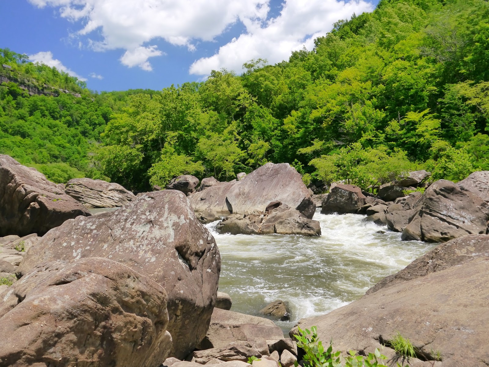
Huge boulder blocks about half the river
Climbing up from the river
Trail crosses tramway and climbs ladder
Laurel Branch on the tramway
Laurel Branch from the end of the tramway
A small waterfall on Laurel Branch
Stairs above the tramway
Trail above the tramway
Another set of stairs with a missing handrail at the top
Huge boulder
Passing through a rock house
Gap in the bluff wall
Sandstone surface
Steps carved in stone
Goat's Rue (Tephrosia virginiana)
A lost compass hanging beside the trail
Soft trail surface
Approaching Gorge Overlook Road
Roadside trail
Descending into the forest
Easy walking!
Trailhead junction
Approaching the road again
Joining the paved walkway to the overlook
Approaching the overlook
Amazing view
Devils Jump Overlook
Looking downstream toward Devils Jump
The view upstream
Devils Jump from above
The trail heads left to bypass the parking lot
The far end of the parking lot
Twin trees seemingly growing out of solid rock
The trail follows the base of the bluff
A very long set of stairs
Log steps below the stairs
Approaching Crack-in-the-Rock
The trail enters the crack...
...and climbs over a boulder
Looking back at the boulder
Approaching the exit crack
Log bridge
A second log bridge
Approaching Blue Heron, the trail take the upper path back to the concession building
Entry to Big South Fork National River & Recreation Area is free.


No comments:
Post a Comment