We drove up to Damascus, Virginia one Saturday morning in late June, 2012, to ride the Virginia Creeper Trail with our good friends, Jay and Pam and their son Joel. On the way, we drove through several areas of dense fog, but the fog cleared and gave way to a beautiful, sunny day with temperatures in the upper 70s. Upon arrival in Damascus, we parked at The Bike Station, rented our bikes and boarded the van for the thirty minute ride to Whitetop Station near the North Carolina border. The trail is owned by the US Forest Service and the municipalities of Abingdon and Damascus. The portion we were riding is in the Mount Rogers National Recreation Area of the Jefferson National Forest.
The elevation at the parking lot at Whitetop is 3560 feet above sea level, Green Cove is 3160, Taylors Valley is 2360, and Damascus is about 1880. I'll need just a wee bit more practice before I attempt to ride up the trail from Damascus to Whitetop.
 |
| Northwest view approximately 1.5 miles down the trail near the tip of Tennessee |
 |
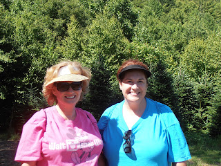
| Pam and Joan |
 |
| Jay zooms by |
| High Bridge over Co Rd 728 and Whitetop Laurel Creek |
 |
| Whitetop Laurel Creek |
 |
| High Bridge from Co Rd 728 |
 |
| Whitetop Laurel Creek at Taylors Valley |
 |
| Water carving |
 |
| View from the through truss bridge |
 |
| They fit the bike to you, not the other way around |
The official trail website is http://www.vacreepertrail.com/.


No comments:
Post a Comment