
I haven't found a listing of locations along the Main Park Road by mile marker and that may be because there are no mile posts along the route. However, I put together the following list to help us judge how much time we needed to allow to drive from one place to the next. These distances are only approximations and do not include the drive off the main road to the parking area, which can be nearly two miles.
|
Location
|
Mile
|
|
Flamingo
|
0.0
|
|
|
0.5
|
|
|
7.0
|
|
Ninemile Pond
|
11.5
|
|
Paurotis Pond
|
13.5
|
|
Mahogany Hammock
|
18.0
|
|
Shark River Slough pull out
|
19.7
|
|
|
23.5
|
|
Pa-hay-okee
|
25.1
|
|
|
26.6
|
|
Long Pine Key
|
33.4
|
|
Royal Palm Key
|
35.6
|
|
|
37.7
|
|
Park Boundary
|
38.3
|
I've already posted information about some of these locations and we did not find time to visit all of the others during our visit in early February, 2013. The park has an entrance fee of $10.00 per car that is valid for seven days. The following is just a small sample of the many things that can be seen during the dry season while driving to some of the more popular locations in the Everglades.
Paurotis Pond
 |
| Paurotis Pond is one of several rookeries in the park |
 |
| Calm water |
 |
| American Wood Stork |
Shark River Slough pull out
 |
| While this may look like a mid-western prairie, the ground is covered in water |
 |
| A pair of cypress domes |
 |
| Pineland areas are rare due to the seasonal flooding |
Dwarf Cypress Forest
 |
| A small elevation change has a huge impact in the Everglades |
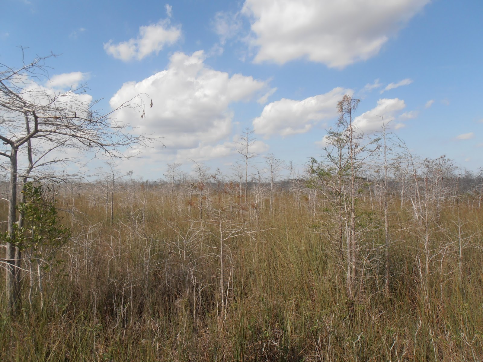 |
| Dwarf cypress trees are deciduous conifers |
 |
| Cypress trees yield to pines as the elevation increases |
 |
| A few cypress still had needles this late in the dry season |
Pa-hay-okee
 |
| From the elevated viewing platform, the saw grass seems to be endless |
 |
| Still on a boardwalk, but closer to the ground |
 |
| Looking back at the elevated boardwalk reveals a variety of habitats |
 |
| Buttressed trunks help cypress tress withstand floods |
Rock Reef Pass
 |
| Rock Reef is the "ridge" that separates Shark River Slough on the west from Taylor Slough on the east |
 |
| Saw grass in Taylor Slough |
 |
| Looking northwest at the tree line that marks the higher elevation of Rock Reef |
 |
| Looking south along Rock Reef |
 |
| The main park road is also known as Ingraham Highway and FL 9336 |
The park website is http://www.nps.gov/ever/index.htm.
No comments:
Post a Comment