We visited the Point Reyes Lighthouse on a foggy afternoon in late August 2013. According to the park service, "Point Reyes is the windiest place on the Pacific Coast and the second foggiest place on the North American continent." The drive from the Bear Valley Visitor Center to the parking area near Point Reyes is about 45 minutes and passes through several historic, operating dairy farms. The public road ends at a turn around and small parking area. On a clear day, there are excellent views to the north-northeast of the incredibly linear Point Reyes Beach.
After finding a place to park, a one-half mile paved road leads to the small visitor center and restroom facility. From here, a concrete ramp and 308 stairs lead down to the lighthouse. The lighthouse was authorized in 1855, but wasn't completed until 1870. It remained operational until 1975. Instead of building the lighthouse on top of the bluff, it was built 275 feet lower with the light at an elevation of 294 feet above the sea. This was to allow the light to be visible through the fog instead of being masked by the fog. A fog horn was located only 100 feet above the sea. The original path to the lighthouse was via wooden steps. These were replaced with concrete in 1929 and again in 2003. The four lightkeepers assigned to the station lived in a two-story dwelling on top of the bluff where the park service dwelling unit is located. A nearby cistern and catchment system was used to provide water to the steam-driven fog horn.
 |
| The trail is paved and accessible up to the very small visitor center |
 |
| Lichens growing on the rocks |
 |
| The small visitor center is on the right |
 |
| The surface portion of the cistern and water collection system |
 |
| A variety of plant life manages to endure the harsh conditions |
 |
| The coastline is hidden by the fog |
 |
| The top of the 308 steps leading to the lighthouse |
 |
| Two usable benches are located along the steps and ramps leading to the lighthouse |
 |
| The lighthouse finally comes into view |
 |
| Waves crash against the rocks far below |
 |
| The original 1870 lighthouse with support buildings |
 |
| Looking east along the bluff toward Sea Lion Cove |
 |
| Looking past the 1962 foghorn compressor building at the path back up to the top of the 612' bluff |
 |
| A better view of the ocean as the fog lifted a bit |
 |
| Waves crash against the headland of Point Reyes |
 |
| This building was used as the fog horn station from 1934 to 1962 |
 |
| Imagine hiking down to the lighthouse on wooden stairs without handrails |
 |
| Red furry algae such as these need no soil and are called "rock violets" (Trentepohlia) |
-001.JPG) |
| Note the wind-sculpted tree behind the ranger residence |
 |
| On sunny days, these few trees provide the only shade along the route, but on foggy days they add to the gloom |
 |
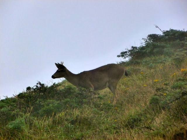
| A black-tailed deer beside the road |
 |
| A pair of black-tailed deer looking for food |
There is no fee to enter Point Reyes National Seashore.
The park website is http://www.nps.gov/pore/index.htm.

No comments:
Post a Comment