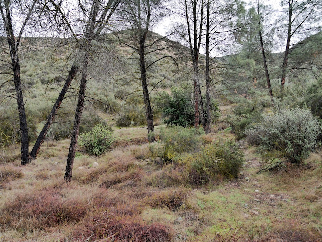
Our March 2018 visit to Pinnacles National Park continued with a short walk along the Old Pinnacles Trail to its junction with the Bench Trail near Chalone Creek. To reach the trail head from the Visitor Center on the east side of the park, drive southwest on CA 146 for 1.9 miles. Just before the bridge over Chalone Creek, turn right onto Chalone Creek Road and drive 0.6 miles to the end of the road. While the road is paved, the parking area is gravel. Parking is available for about 15 passenger vehicles.
The trail begins at the north end of the parking area. The ¼ mile portion of the trail we walked is mostly level with a crushed or pea gravel packed surface. Even though we visited during the rainy season and had periods of rain all day, the trail surface was well-drained except for a couple of low-lying spots. While the trail didn't provide great scenic vistas, it did provide a nice walk on a dreary day through a riparian ecosystem.
 |
| Topographic map with GPS route |
 |
| Rock outcrop on flank of Machete Ridge |
 |
| Evidence of fire |
 |
| Chalone Creek floodplain |
 |
| Fremont Cottonwood (Populus fremontii) |
 |
| Standing water on the trail |
 |
| Another view of the rock outcrop |
 |
| Typical trail condition |
 |
| Machete Ridge |
 |
| Junction with Bench Trail new Chalone Creek |
 |
| Looking upstream from the trail bridge |
 |
| Bridge over Chalone Creek |
 |
| Chalone Creek |
 |
| One final look at the outcrop before turning back |
 |
| More evidence of fire |
 |
| Coast Live Oak (Quercus agrifolia) |
Entrance to Pinnacles National Park requires an entry fee of $25 per passenger vehicle for a 7-day pass. Any of the America the Beautiful passes may be used instead.
The park website is https://www.nps.gov/pinn.

No comments:
Post a Comment