
Although we had planned to hike the Cucumber Gap loop in mid-March 2016, when we got to the Cucumber Gap Trail junction, we changed our plans and followed the Little River Trail upstream to the Goshen Prong Trail. I described that hike here. We finally hiked the loop in late April 2016. We parked at the upper paved hiker parking area near the Jakes Creek Trail trailhead. We walked down the road to the lower parking area and the Little River Trail trailhead and hiked upstream to the Cucumber Gap Trail junction. While most of the Little River Trail is a single lane gravel road up to the Goshen Prong Trail, the Cucumber Gap Trail is a wide dirt path with protruding roots and rocks. Most places are wide enough to meet another hiker without having to step off the trail. At the west end of the Cucumber Gap trail we headed north on the gravel road that is the Jakes Creek Trail. Note that this trail is also used by equestrians. We were a bit late for the spring ephemeral wild flowers, but still saw enough to make the hike up to the gap and down again enjoyable. Several of the abandoned buildings of the Elkmont resort community are still located along the lower end of the Jakes Creek Trail. The loop climbs and falls 750 feet with the highest elevation at Cucumber Gap and the lowest elevation between the two hiker parking areas in Elkmont. The route along Jakes Creek is much steeper than the Little River Trail.
Unless the wildflowers are blooming along the Cucumber Gap Trail or you want a bit of solitude, I'd suggest hiking further up the Little River Trail and retracing your steps for a more enjoyable and scenic hike.
 |
| Topographic map with GPS route |
 |
| Elevation profile |
 |
| Little River |
 |
| Island with a carpet of green moss and grass |
 |
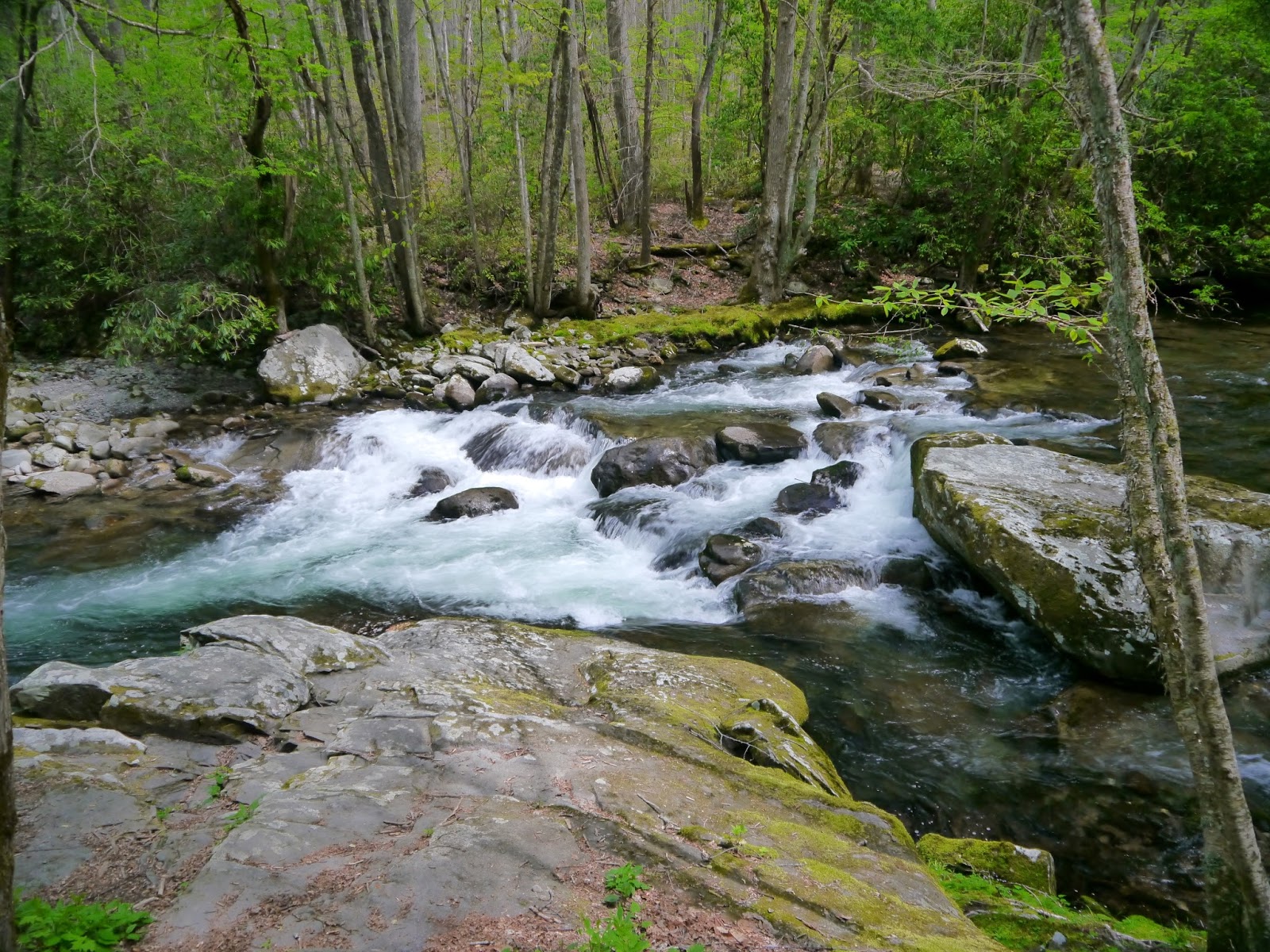
| Cascade on Little River |
 |
| Yellow Trillium (Trillium luteum) |
 |
| Another cascade |
 |
| Dogwood above the Little River |
 |
| Canadian Violet (Viola canadensis) |
 |
| Turnaround at the end of the old road about one mile up the trail |
 |
| Another noisy cascade on the river |
 |
| Little River flows over a series of boulders |
 |
| View from the log bench |
 |
| Husky Branch Falls |
 |
| Husky Branch flows into Little River |
 |
| Cucumber Gap Trail trailhead to right |
 |
| The smooth trail surface provided a false hope... |
 |
| ...as we found plenty of roots and mud along the trail |
 |
| The trail looks like a sunken road |
 |
| Root-bound trail |
 |
| The Cucumber Gap Trail crosses Husky Branch without the benefit of a bridge |
 |
| Another sunken section of the trail |
 |
| Fungi face |
 |
| More roots and rocks as the trail weaves among the hardwoods |
 |
| The trail follows a small stream for a short distance |
 |
| Root stairs |
 |
| This rock is the only "bench" on the Cucumber Gap Trail |
 |
| Sweet White Trillium (Trillium simile) |
 |
| Foamflower (Tiarella cordifolia) |
 |
| Blown down trees have been cleared from the trail |
 |
| Yellow Trillium (Trillium luteum) |
 |
| More Sweet White Trillium |
 |
| Approaching the high point on the trail |
 |
| Beginning the descent toward the Jakes Creek Trail |
 |
| Burnt Mountain (3373') |
 |
| The trail crosses a very shallow Tulip Branch |
 |
| A small stream flows into Tulip Branch |
 |
| A hillside covered in trillium and foamflower |
 |
| A small stream flows through a culvert covered by rocks |
 |
| More roots |
 |
| Cucumber Gap Trail ends at intersection with Jakes Creek Trail |
 |
| Typical view from and surface of Jakes Creek Trail |
 |
| A wooden drain allows runoff to flow into Tulip Branch |
 |
| Tulip Branch |
 |
| A modern gate across a side road seems out of place |
 |
| Jakes Creek from the cemetery road bridge |
Entry to Great Smoky Mountains National Park is free.
The park website is http://www.nps.gov/grsm/index.htm.
No comments:
Post a Comment