
Our February 2015 trip to southern California continued with a second day at Mojave National Preserve to hike over 3.4 miles on the Kelso Dunes. The dunes are located south of Kelso. To reach the trailhead from Kelso, drive 7.8 miles south on Kelbaker Road to a signed gravel road on the right. Drive 2.9 miles west on the gravel road to a parking area with interpretive signs and a vault toilet. The first ½ mile of the trail is very obvious and consists of a fairly solid combination of sand and gravel. Once in the dunes, the trail splits into numerous paths through the soft sand. The elevation gradually increases as each wave of dunes is higher than the previous. Walking sticks make this part of the hike much easier. We deliberately chose a path away from the few dozen other hikers that included a Cub Scout troop on a holiday weekend outing. Once away from the crowds, we enjoyed a leisurely walk along the ridgelines of the dunes until we reached the summit over 500 feet above the surrounding landscape. We used a combination of plunge stepping and glissading to descend the steep face of the dune. While descending, we heard and felt the low frequency booming sound that Kelso Dunes is noted for. The sound is only created in dunes with uniform small grains of silica sand. The sound is generated by surface sand slipping past stationary sand. This can be caused by wind or by the mini-avalanches our descent created.
Please be prepared when hiking in the desert. This includes having a first aid kit, map and plenty of sunscreen. We carried and drank plenty of water, even though the temperature was in the mid 70s.
 |
| Hiking route |
 |
| Elevation profile |
 |
| Three mile gravel access road from Kelbaker Road |
 |
| Parking area at trailhead |
 |
| The trail quickly heads into the wilderness area of the preserve |
 |
| The initial trail is well defined and relatively easy walking |
 |
| Looking back at part of the Granite Mountains |
 |
| The trail splits into multiple paths |
 |
| Looking east to the Providence Mountains |
 |
| Following a little used ridge line |
 |
| Vegetation helps stabilize the dunes |
 |
| Looking back at the trail |
 |
| A few more foot prints along this ridge |
 |
| Another view of the Providence Mountains |
 |
| Ripples created by the wind |
 |
| A saddle between dunes presents our first view of the Kelso Mountains to the north |
 |
| Not much further to the top |
 |
| Looking south toward the trail with the Providence Mountains on the left and the Granite Mountains on the right |
 |
| Continuing to climb higher |
 |
| My lovely wife on the dunes with the Providence Mountains |
 |
| Taken by my wife as I was taking her picture |
 |
| Another picture taken by my beautiful bride |
 |
| The final ridge to the top |
 |
| Granite Mountains from the top of the dunes |
 |
| Looking south across the dunes to the trail and access road |
 |
| Looking southwest across the Bristol Mountains to San Gorgonio Mountain |
 |
| Looking across Devils Playground and Jackass Canyon to Old Dad Mountain |
 |
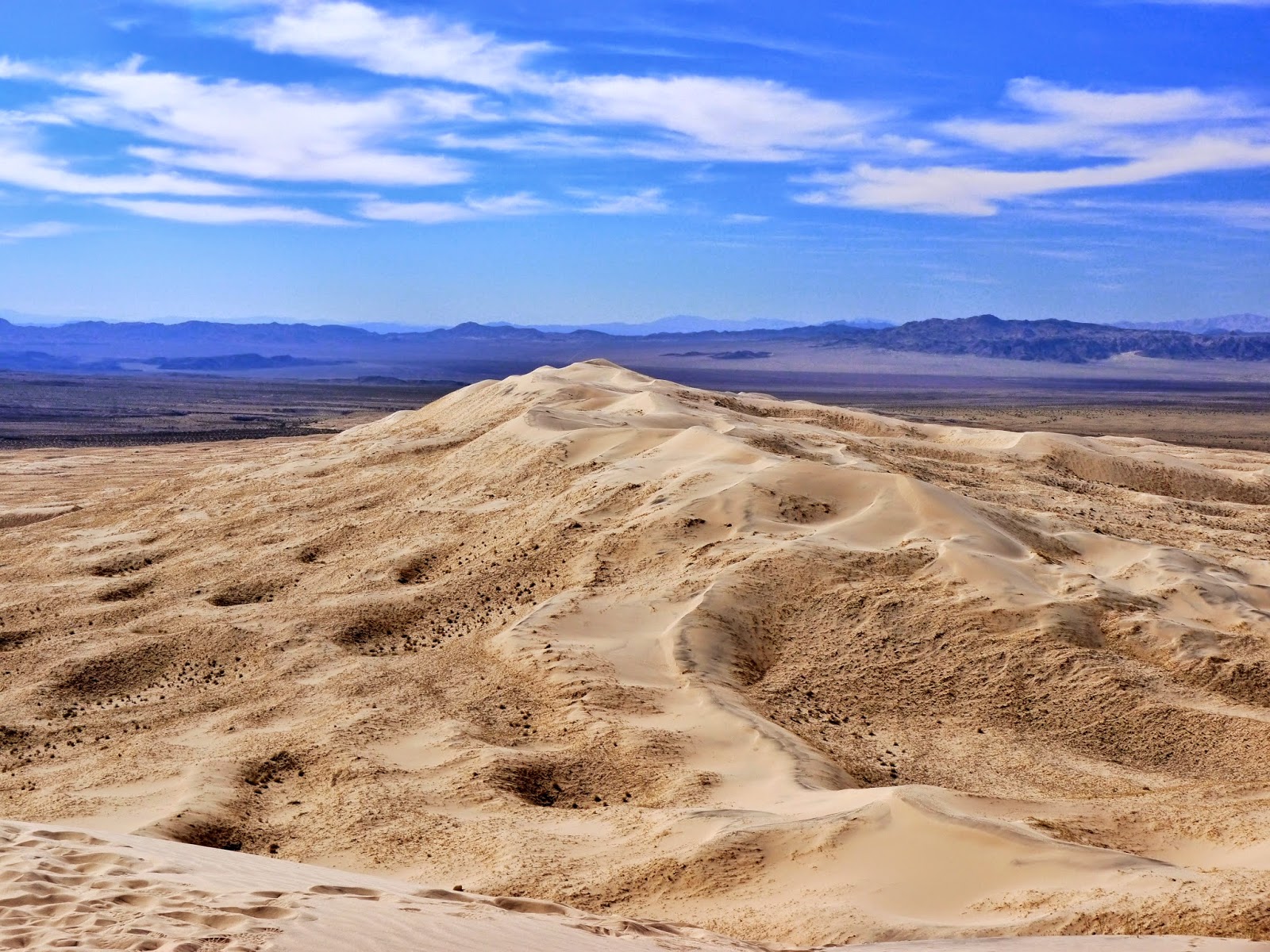
| Looking east with Kelso on the left and the Providence Mountains on the right |
 |
| A beautiful day for a hike on the dunes |
 |
| Looking west across the dunes to the Bristol Mountains |
 |
| Looking northeast across the Devils Playground to the Kelso Mountains |
 |
| Looking east across the dues to the Providence Mountains |
 |
| Looking south with the Providence and Granite Mountains |
 |
| It is steeper than it looks |
 |
| Looking back at our steep descent |
 |
| Clouds forming over the Granite Mountains |
 |
| Looking back at the dunes from the trail |
Entrance to Mojave National Preserve is free.
The park website is http://www.nps.gov/moja/index.htm.
These pictures are great, John! It is difficult to tell how very steep the ridges are though, hard to capture that in a photo.
ReplyDelete