
Our February 2015 visit to southern Nevada and southern California included a planned drive through the Mojave Preserve. The preserve is the third largest tract of land administered by the US National Park Service in the contiguous 48 states behind Death Valley National Park and Yellowstone National Park. We found so much to do that we added a day to our visit. Our first stop was to hike the Teutonia Peak Trail. The trailhead is an unmarked sandy pullout on west side of Cima Road near the Mojave Memorial Cross. The location is about 11.2 miles south of the Stateline Service Station at Interstate 15 exit 272 and about 6.4 miles north of Cima, California.
According to the sign at the trailhead, the trail "passes through the densest concentration of Joshua trees in the world." Over a distance of 1.6 miles, the trail climbs about 700 feet to a rocky outcrop on the northeastern side of Cima Dome. Elevation at the end of the trail is about 5713 feet above sea level. The actual summit is another ¼ mile of rock climbing south of the end of the trail. Cima Dome is a nearly symmetrical dome rising 1500 feet, spanning nearly 10 miles and covering 70 square miles.
Besides the standard desert hiking warnings about carrying enough water, watching for snakes and being aware of cactus on or near the trail, this trail also passes by several abandoned mines. Please don't wander beyond posted warning signs or attempt to climb fences to get a better view of the mines.
 |
| Topographic map of the trail |
 |
| Trail elevation profile |
 |
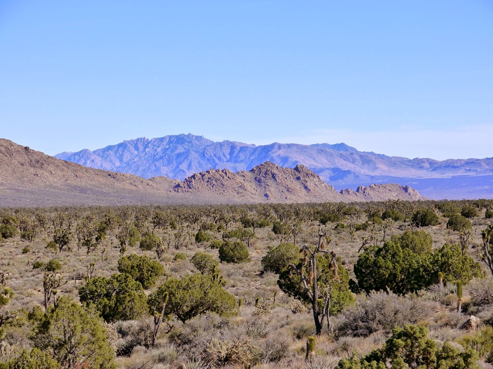
| Joshua trees, juniper trees, yucca and creosote bushes |
 |
| Teutonia Peak from near the trailhead |
 |
| Mojave Memorial Cross on the white rock in the distance |
 |
| The Joshua tree is a member of the Agave family |
 |
| Cholla cactus |
 |
| A young Joshua tree |
 |
| Igneous rock intrusion through a fault in the older rock |
 |
| The Joshua tree forest seems to go on forever |
 |
| Cholla cactus and Teutonia Peak |
 |
| The lower portion of the trail follows an old 4WD road |
 |
| A Joshua tree towers over the trail |
 |
| Waterbars have been built into the trail |
 |
| Junipers become more common at higher elevations |
 |
| Remains of an abandoned silver mine |
 |
| Kessler Peak |
 |
| Old Man cactus |
 |
| Beyond the mine, the trail steepens |
 |
| Another view of Kessler Peak |
 |
| The trail turns off the road, but not before providing this spectacular view |
 |
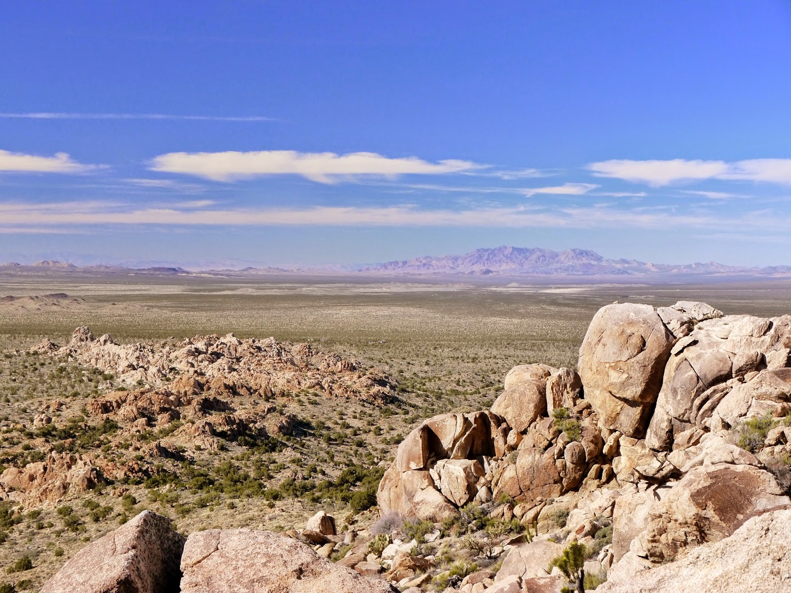
| Ivanpah Mountains |
 |
| Another view of the Ivanpah Mountains |
 |
| Clark Mountain and the Mescal Range |
 |
| Kessler Peak in the Ivanpah Mountains |
 |
| New York Mountains |
 |
| The trail narrows and climbs rock steps |
 |
| Another view of Clark Mountain |
 |
| A trail passes through here somewhere |
 |
| Rugged country |
 |
| Clark Mountain from the trail |
 |
| More stairs |
 |
| Cima Dome |
 |
| More Old Man Cactus along the trail |
 |
| Prickly pear cactus along the trail |
 |
| One of the lesser summits of Teutonia Peak |
 |
| Juniper, Joshua tree and prickly pear greet us near the summit |
 |
| The aptly named Shadow Valley |
 |
| Still a bit more climbing to the end of the trail |
 |
| Looking north to Clark Mountain |
 |
| Looking southeast toward the New York Mountains |
 |
| Looking north toward Clark Mountain |
 |
| Prickly pear on the rocks |
 |
| Looking east to the New York Mountains |
 |
| Looking northeast toward the Mescal Range and Striped Mountain |
Entrance to Mojave National Preserve is free.
The park website is http://www.nps.gov/moja/index.htm.
No comments:
Post a Comment