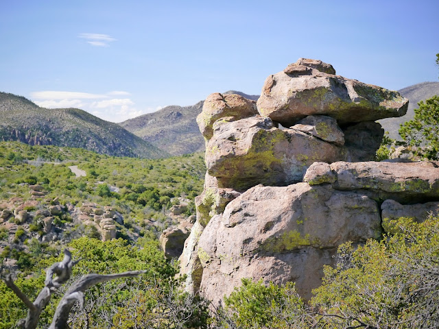
Massai Point is located at the end of Bonita Canyon Drive in Chiricahua National Monument. At an elevation of 6870 feet, it is more than 2000 feet above the surrounding grasslands. When the Turkey Creek volcano south of the monument erupted, it deposited hot ash that melted and coalesced into rhyolite. As the rhyolite cooled, it cracked vertically and horizontally. Untold years of wind, water and freeze/dry cycles have sculpted the remaining rhyolite into pinnacles and balanced rocks.
A short nature walk surrounds the parking area at the end of the road. While the nature trail is not accessible, wonderful views of the surrounding landscape are visible from a vehicle. In addition, an accessible trail or stairs lead to an exhibit building atop Massai Point. We stopped during our May 2015 visit to the monument.
 |
| Looking west from the parking area across Sulphur Springs Valley to the Dragoon Mountains |
 |
| Looking north at Bonita Canyon Drive |
 |
| Columns and more columns |
 |
| Looking south toward the southern Chiricahua Mountains and the Coronado National Forest |
 |
| Fins and columns |
 |
| Looking northwest to Sugarloaf Mountain (7310') |
 |
| Pinnacles below Sugarloaf Mountain |
 |
| Split, but still standing |
 |
| A tree struggles to survive above the rows of rocks |
 |
| Exhibit building |
 |
| Interior of the exhibit building |
 |
| View to the south from the exhibit building |
 |
| Note the observation building on Sugarloaf Mountain |
 |
| Cochise Head - named after the chief of the Chiricahua Apaches |
 |
| Harris Mountain (5632' with road), San Simon Valley and the Peloncillo Mountains |
 |
| Higher peaks of the Chiricahua Mountains to the south |
 |
| Dragoon Mountains (40 miles distant) |
 |
| Leaning rocks |
 |
| Eastern wall of the caldera of the Turkey Creek volcano |
 |
| Dos Cabezas Peaks (8354', 22 miles) |
 |
| Another look east at Harris Mountain |
Entrance to Chiricahua National Monument is free.
The park website is http://www.nps.gov/chir/index.htm.

No comments:
Post a Comment